|
search place name
|
||
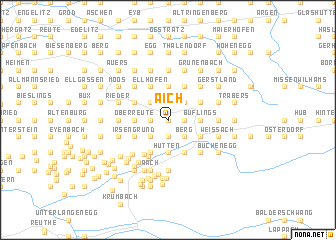
Aich (Bayern, Germany)Aich is a town in the Bayern region of Germany. An overview map of the region around Aich is displayed below.
regional and 3d topo map of Aich, Germany ::
Aich airports ::
The nearest airport is ACH - St Gallen Altenrhein, located 33.1 km west of Aich.
Other airports nearby include FDH - Friedrichshafen (37.3 km west), INN - Innsbruck (108.2 km east), ZRH - Zurich (108.6 km west), OBF - Oberpfaffenhofen (112.9 km north east), Nearby towns ::
Iringshofen (0.0km north) //
Vorderreute (0.0km north) //
Mittelhofen (1.9km north) //
Isenbretshofen (1.9km north) //
Buch (1.9km north) //
Hopfen (1.3km west) //
Saneberg (1.3km east) //
Genhofen (1.3km east) //
Hinterreute (1.9km south) //
Laufenegg (1.9km south) //
Burkatshofen (2.2km north west) //
Balzhofen (2.2km north west) //
Hahnschenkel (2.2km north east) //
Lautenberg (2.2km north east) //
Ranzenried (2.2km north east) //
Gschwend (2.2km south west) //
Willis (2.2km south east) //
Berg (2.2km south east) //
Oberreute (2.5km west) //
Beule (2.5km west) //
Langenried (2.5km west) //
Heimhofen (3.7km north) //
Rutzhofen (3.7km north) //
Hütten (3.7km south) //
Krebs (3.7km south) //
Zell (2.5km east) //
Pfalzen (2.5km east) //
Buflings (2.5km east) //
Sinswang (2.5km east) //
[all distances 'as the bird flies' and approximate] 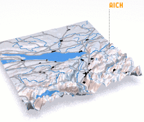 Places with similar names to Aich, Germany ::
Disclaimer :: Information on this page comes without warranty of any kind |
||
|
Where is Aich? Elevation and coordinates ::
Latitude (lat): 47°34'0"N Longitude (lon): 9°59'0"E
Elevation (approx.): 923m (map arrows pan, magnifying glasses zoom) |
||
|
Visiting Aich? Hotel/Accommodation ::
Book a hotel in Aich Travel Guide ::
Buy a travel guide for Germany rental cars ::
car rental offers GPS waypoint ::
download a GPX waypoint (PoI) of Aich for your GPS receiver
|
||