|
search place name
|
||
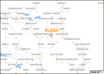
Algier (Sachsen, Germany)Algier is a town in the Sachsen region of Germany. An overview map of the region around Algier is displayed below.
regional and 3d topo map of Algier, Germany ::
Algier airports ::
The nearest airport is BBJ - Bautzen, located 32.8 km south west of Algier.
Other airports nearby include DRS - Dresden (84.5 km west), IEG - Zielona Gora Babimost (107.7 km north east), WRO - Wroclaw Strachowice (138.8 km east), PRG - Prague Ruzyne (145.1 km south), Nearby towns ::
Dunkelhäuser (0.0km north) //
Jakobshäuser (1.2km west) //
Geheege (2.2km south east) //
Uhsmannsdorf (2.3km west) //
Biehain (3.7km south) //
Rothenburg (2.3km east) //
Noës (3.0km north east) //
Bremenhain (3.9km north) //
Mittel Horka (4.4km south west) //
Horka (4.4km south west) //
Neusorge (5.6km north) //
Ober Spreehammer (3.5km west) //
Spreehammer (3.5km west) //
Nieder Spreehammer (3.5km west) //
Bleiche (3.5km east) //
Spreeaufwurf (5.7km north) //
Spree (3.9km north west) //
Antheil-Mückenhain (6.0km south west) //
Lodenau (6.0km north east) //
Margaretenhof (7.4km north) //
Kaltwasser (7.5km south) //
Nieder Neundorf (5.0km east) //
Heinrichswalde (6.6km north west) //
Mückenhain (7.8km south) //
Hähnichen (5.9km north west) //
Särichen (8.2km south west) //
[all distances 'as the bird flies' and approximate]  Places with similar names to Algier, Germany ::
Disclaimer :: Information on this page comes without warranty of any kind |
||
|
Where is Algier? Elevation and coordinates ::
Latitude (lat): 51°20'0"N Longitude (lon): 14°56'0"E
Elevation (approx.): 164m (map arrows pan, magnifying glasses zoom) |
||
|
Visiting Algier? Hotel/Accommodation ::
Book a hotel in Algier Travel Guide ::
Buy a travel guide for Germany rental cars ::
car rental offers GPS waypoint ::
download a GPX waypoint (PoI) of Algier for your GPS receiver
|
||