|
search place name
|
||
Altreuth (Bayern, Germany)Altreuth is a town in the Bayern region of Germany. An overview map of the region around Altreuth is displayed below.
regional and 3d topo map of Altreuth, Germany ::

Altreuth airports ::
The nearest airport is LNZ - Linz (Horsching), located 86.6 km south east of Altreuth.
Other airports nearby include SZG - Salzburg (111.0 km south), MUC - Munich Munchen (123.1 km west), KLV - Karlovy Vary (162.6 km north), PRG - Prague Ruzyne (162.9 km north east), Nearby towns ::
Thurmannsbang (1.2km west) //
Hundsruck (1.9km north) //
Haufang (1.9km north) //
Sumpering (1.9km north) //
Bruckwiesreuth (1.2km east) //
Lanzenreuth (1.2km east) //
Eggenreuth (1.9km south) //
Entschenreuth (2.2km north west) //
Rabenstein (2.2km south west) //
Senging (2.2km north east) //
Saldenburg (2.2km north east) //
Platten (2.2km north east) //
Loderhof (2.2km south east) //
Goben (2.2km south east) //
Miesberg (3.7km north) //
Gingharting (2.4km west) //
Wendlberg (3.7km south) //
Sanzenhof (3.7km south) //
Haundorf (3.1km north west) //
Lindau (3.1km north west) //
Gumpenreith (3.9km north) //
Hals (3.9km north) //
Reuth (3.9km south) //
Kollnberg (3.9km south) //
Stützersdorf (3.1km south east) //
Rothau (3.9km south) //
Eisensteg (3.9km south) //
Englburg (3.9km south) //
Hötzendorf (4.4km south east) //
[all distances 'as the bird flies' and approximate] 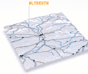 Places with similar names to Altreuth, Germany :: Disclaimer :: Information on this page comes without warranty of any kind |
||
|
Where is Altreuth? Elevation and coordinates ::
Latitude (lat): 48°46'0"N Longitude (lon): 13°20'0"E
Elevation (approx.): 503m (map arrows pan, magnifying glasses zoom) |
||
|
Visiting Altreuth? Hotel/Accommodation ::
Book a hotel in Altreuth Travel Guide ::
Buy a travel guide for Germany rental cars ::
car rental offers GPS waypoint ::
download a GPX waypoint (PoI) of Altreuth for your GPS receiver
|
||