|
search place name
|
||
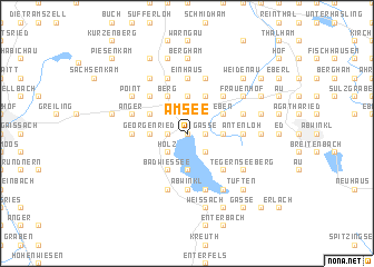
Am See (Bayern, Germany)Am See is a town in the Bayern region of Germany. An overview map of the region around Am See is displayed below.
regional and 3d topo map of Am See, Germany ::
Am See airports ::
The nearest airport is OBF - Oberpfaffenhofen, located 49.9 km north west of Am See.
Other airports nearby include FEL - Fuerstenfeldbruck Furstenfeldbruck (61.5 km north west), INN - Innsbruck (61.9 km south west), MUC - Munich Munchen (67.3 km north), SZG - Salzburg (95.4 km east), Nearby towns ::
Gmund am Tegernsee (0.0km north) //
Buchleiten (0.0km north) //
Kaltenbrunn (1.2km west) //
Finsterwald (1.2km west) //
Osterberg (1.2km east) //
Schwärzenbach (1.2km east) //
Gasse (1.2km east) //
Dürnbach (1.9km north) //
Lehen (2.2km north west) //
Keilsried (2.2km north west) //
Holz (2.2km south west) //
Riedern (2.2km north west) //
Rohbogen (2.2km south west) //
Mühlthal (2.2km north east) //
Festenbach (2.2km north east) //
Sankt Quirin (2.2km south east) //
Georgenried (2.5km west) //
Steinberg (2.5km west) //
Kreuzstraße (3.7km north) //
Alt Wiessee (3.7km south) //
Moosrain (3.7km north) //
Öd (2.5km east) //
Ostin (2.5km east) //
Bad Wiessee (3.9km south) //
Staudach (3.9km north) //
Baumgarten (3.9km north) //
Berg (3.9km north) //
Hauserdörfl (3.1km north west) //
Laffenthal (3.9km north) //
[all distances 'as the bird flies' and approximate] 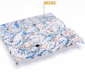 Places with similar names to Am See, Germany ::
Disclaimer :: Information on this page comes without warranty of any kind |
||
|
Where is Am See? Elevation and coordinates ::
Latitude (lat): 47°45'0"N Longitude (lon): 11°44'0"E
Elevation (approx.): 743m (map arrows pan, magnifying glasses zoom) |
||
|
Visiting Am See? Hotel/Accommodation ::
Book a hotel in Am See Travel Guide ::
Buy a travel guide for Germany rental cars ::
car rental offers GPS waypoint ::
download a GPX waypoint (PoI) of Am See for your GPS receiver
|
||