|
search place name
|
||
Anger (Bayern, Germany)Anger is a town in the Bayern region of Germany. An overview map of the region around Anger is displayed below.
regional and 3d topo map of Anger, Germany ::

Anger airports ::
The nearest airport is BYU - Bayreuth, located 38.7 km south east of Anger.
Other airports nearby include HOQ - Hof Plauen (53.2 km east), NUE - Nuernberg Nurnberg (70.8 km south), ERF - Erfurt (95.1 km north), GHF - Giebelstadt Aaf (100.7 km south west), Nearby towns ::
Obersdorf (0.0km north) //
Roth (1.9km south) //
Degendorf (1.2km west) //
Thelitz (1.2km east) //
Trieb (2.2km north west) //
Hochstadt am Main (2.2km north east) //
Mönchkröttendorf (3.7km south) //
Reuth (2.4km east) //
Schwürbitz (3.7km north) //
Klosterlangheim (3.0km south west) //
Isling (3.9km south) //
Zettlitz (3.0km north east) //
Wolfsloch (3.0km north east) //
Marktzeuln (4.4km north east) //
Michelau (4.4km north west) //
Zeublitz (3.6km east) //
Mistelfeld (3.6km west) //
Spiesberg (4.0km south east) //
Burkheim (4.0km south east) //
Altendorf (5.7km south) //
Lahm (5.7km south) //
Burgstall (4.0km north east) //
Horb (4.0km north east) //
Lettenreuth (5.7km north) //
Oberreuth (5.7km north) //
Tauschendorf (5.1km south east) //
Siedamsdorf (6.0km south east) //
Oberlangheim (5.1km south west) //
Neuensee (6.0km north west) //
[all distances 'as the bird flies' and approximate] 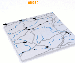 Places with similar names to Anger, Germany ::
Disclaimer :: Information on this page comes without warranty of any kind |
||
|
Where is Anger? Elevation and coordinates ::
Latitude (lat): 50°8'0"N Longitude (lon): 11°9'0"E
Elevation (approx.): 304m (map arrows pan, magnifying glasses zoom) |
||
|
Visiting Anger? Hotel/Accommodation ::
Book a hotel in Anger Travel Guide ::
Buy a travel guide for Germany rental cars ::
car rental offers GPS waypoint ::
download a GPX waypoint (PoI) of Anger for your GPS receiver
|
||