|
search place name
|
||
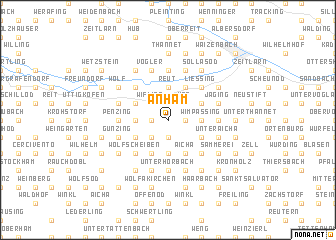
Anham (Bayern, Germany)Anham is a town in the Bayern region of Germany. An overview map of the region around Anham is displayed below.
regional and 3d topo map of Anham, Germany ::
Anham airports ::
The nearest airport is SZG - Salzburg, located 86.4 km south of Anham.
Other airports nearby include LNZ - Linz (Horsching) (87.5 km south east), MUC - Munich Munchen (101.2 km west), FEL - Fuerstenfeldbruck Furstenfeldbruck (142.8 km west), OBF - Oberpfaffenhofen (146.3 km west), Nearby towns ::
Stocköd (1.9km north) //
Langenbruck (1.2km east) //
Adenberg (1.9km north) //
Aidenbach (1.2km west) //
Thal (1.9km south) //
Beutelsbach (1.9km south) //
Unterbeutelsbach (1.9km south) //
Schwanham (2.2km north east) //
Maierholz (2.2km north east) //
Weg (2.2km north east) //
Watzmannsberg (2.2km north east) //
Wifling (2.2km north west) //
Unterholzen (2.2km south west) //
Wimpassing (2.5km east) //
Reut (3.7km north) //
Altham (3.7km north) //
Untertillbach (3.7km south) //
Karling (2.5km west) //
Hollerbach (2.5km west) //
Heft (2.5km west) //
Siegl (3.1km north east) //
Aunkirchen (3.9km north) //
Ledering (3.1km south east) //
Aicha (3.9km south) //
Gumperting (3.1km north west) //
Oberthambach (3.9km south) //
Martinstödling (3.1km south west) //
Algerting (4.4km north east) //
Liessing (4.4km north east) //
[all distances 'as the bird flies' and approximate] 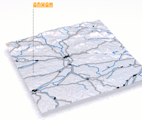 Places with similar names to Anham, Germany ::
Disclaimer :: Information on this page comes without warranty of any kind |
||
|
Where is Anham? Elevation and coordinates ::
Latitude (lat): 48°34'0"N Longitude (lon): 13°7'0"E
Elevation (approx.): 371m (map arrows pan, magnifying glasses zoom) |
||
|
Visiting Anham? Hotel/Accommodation ::
Book a hotel in Anham Travel Guide ::
Buy a travel guide for Germany rental cars ::
car rental offers GPS waypoint ::
download a GPX waypoint (PoI) of Anham for your GPS receiver
|
||