|
search place name
|
||
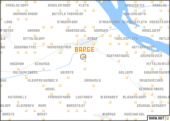
Barge (Niedersachsen, Germany)Barge is a town in the Niedersachsen region of Germany. An overview map of the region around Barge is displayed below.
regional and 3d topo map of Barge, Germany ::
Barge airports ::
The nearest airport is XFW - Hamburg Finkenwerder, located 24.8 km east of Barge.
Other airports nearby include HAM - Hamburg (35.3 km east), BRV - Bremerhaven (59.6 km west), BRE - Bremen (73.4 km south west), LBC - Luebeck Lubeck Blankensee (86.9 km east), Nearby towns ::
Riensförde (0.0km north) //
Hagen (1.9km south) //
Groß Thun (2.2km north west) //
Klein Thun (2.2km north west) //
Stade (3.9km north) //
Campe (3.9km north) //
Schwarzenberg (3.9km north) //
Deinste (4.3km south west) //
Schölisch (5.6km north) //
Kehdingertors Vorstadt (5.6km north) //
Sandkrug (5.7km south) //
Helmste (5.7km south) //
Wiepenkathen (3.8km north west) //
Hohenwedel (5.7km north) //
Speersort (5.0km north east) //
Wöhrden (6.0km north) //
Brunshausen (6.0km north) //
Götzdorf (7.4km north) //
Agathenburg (4.4km east) //
Schnee (7.5km north) //
Groß Fredenbeck (6.5km south west) //
Melau (6.5km north east) //
Hollernstraße (5.8km north east) //
Stadermoor (7.7km north) //
Haddorf (5.8km north west) //
Lühnenspecken (7.7km south) //
Stader Sand (8.1km north east) //
Bassenfleth (7.1km north east) //
Ritschermoor (8.6km north west) //
[all distances 'as the bird flies' and approximate]  Places with similar names to Barge, Germany ::
Disclaimer :: Information on this page comes without warranty of any kind |
||
|
Where is Barge? Elevation and coordinates ::
Latitude (lat): 53°34'0"N Longitude (lon): 9°28'0"E
Elevation (approx.): 13m (map arrows pan, magnifying glasses zoom) |
||
|
Visiting Barge? Hotel/Accommodation ::
Book a hotel in Barge Travel Guide ::
Buy a travel guide for Germany rental cars ::
car rental offers GPS waypoint ::
download a GPX waypoint (PoI) of Barge for your GPS receiver
|
||