|
search place name
|
||
Bernhofen (Baden-Württemberg, Germany)Bernhofen is a town in the Baden-Württemberg region of Germany. An overview map of the region around Bernhofen is displayed below.
regional and 3d topo map of Bernhofen, Germany ::

Bernhofen airports ::
The nearest airport is FDH - Friedrichshafen, located 13.1 km south of Bernhofen.
Other airports nearby include ACH - St Gallen Altenrhein (33.2 km south), ZQL - Donaueschingen Villingen (80.9 km west), ZRH - Zurich (84.3 km south west), STR - Stuttgart (104.0 km north), Nearby towns ::
Hübscher (0.0km north) //
Hochberg (0.0km north) //
Hinter-Storchen (1.2km east) //
Vorder-Storchen (1.2km east) //
Riesen (1.9km south) //
Aulwangen (1.9km north) //
Vorderweißenried (1.9km north) //
Hagenbach (1.2km west) //
Rahlen (2.2km south east) //
Ganter (2.2km south west) //
Schmalegg (2.2km north west) //
Wolfsberg (2.2km north west) //
Büchel (2.5km east) //
Metzisweiler (3.7km south) //
Oberzell (3.7km south) //
Bergle (3.7km south) //
Vockenweiler (3.7km north) //
Unterloch (3.7km north) //
Nessenbach (2.5km west) //
Weißenbach (3.1km south east) //
Weingartshof (3.1km south east) //
Weißenau (3.1km south east) //
Weiherstobel (3.9km south) //
Reute (3.9km south) //
Großtobel (3.1km north east) //
Kleintobel (3.1km north east) //
Oberweiler (3.9km south) //
Inntobel (3.9km north) //
Eschau (3.1km south west) //
[all distances 'as the bird flies' and approximate] 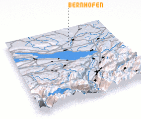 Places with similar names to Bernhofen, Germany ::
// Bauernhöfen (DE)
// Burnhaven (GB)
Disclaimer :: Information on this page comes without warranty of any kind |
||
|
Where is Bernhofen? Elevation and coordinates ::
Latitude (lat): 47°47'0"N Longitude (lon): 9°34'0"E
Elevation (approx.): 503m (map arrows pan, magnifying glasses zoom) |
||
|
Visiting Bernhofen? Hotel/Accommodation ::
Book a hotel in Bernhofen Travel Guide ::
Buy a travel guide for Germany rental cars ::
car rental offers GPS waypoint ::
download a GPX waypoint (PoI) of Bernhofen for your GPS receiver
|
||