|
search place name
|
||
Birkenhainchen (Brandenburg, Germany)Birkenhainchen is a town in the Brandenburg region of Germany. An overview map of the region around Birkenhainchen is displayed below.
regional and 3d topo map of Birkenhainchen, Germany ::

Birkenhainchen airports ::
The nearest airport is SXF - Berlin Schonefeld, located 54.2 km north west of Birkenhainchen.
Other airports nearby include THF - Berlin Tempelhof (67.3 km north west), TXL - Berlin Tegel (79.7 km north west), BBJ - Bautzen (97.2 km south), DRS - Dresden (100.3 km south), Nearby towns ::
Groß Leuthen (1.9km north) //
Dollgen (1.1km west) //
Klein Leuthen (2.2km north east) //
Groß Leine (2.2km south east) //
Leibchel (2.3km east) //
Glietz (2.3km east) //
Wittmannsdorf-Brückchen (5.6km north) //
Klein Leine (5.6km south) //
Bückchen (5.7km north) //
Gröditsch (5.0km north west) //
Wittmannsdorf (7.4km north) //
Buschhäuser (7.5km north) //
Krugau (4.9km west) //
Caminchen (7.5km south) //
Siegadel (4.9km east) //
Wiese (6.5km north east) //
Pretschen (8.2km north west) //
Schuhlen-Wiese (7.2km north east) //
Schulen (7.2km north east) //
Briesensee (8.2km south west) //
Sacrow (8.7km south east) //
[all distances 'as the bird flies' and approximate] 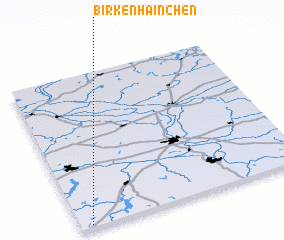 Places with similar names to Birkenhainchen, Germany :: Disclaimer :: Information on this page comes without warranty of any kind |
||
|
Where is Birkenhainchen? Elevation and coordinates ::
Latitude (lat): 52°1'0"N Longitude (lon): 14°3'0"E
Elevation (approx.): 54m (map arrows pan, magnifying glasses zoom) |
||
|
Visiting Birkenhainchen? Hotel/Accommodation ::
Book a hotel in Birkenhainchen Travel Guide ::
Buy a travel guide for Germany rental cars ::
car rental offers GPS waypoint ::
download a GPX waypoint (PoI) of Birkenhainchen for your GPS receiver
|
||