|
search place name
|
||
Bleichenbach (Hessen, Germany)Bleichenbach is a town in the Hessen region of Germany. An overview map of the region around Bleichenbach is displayed below.
regional and 3d topo map of Bleichenbach, Germany ::

Bleichenbach airports ::
The nearest airport is ZNF - Hanau Aaf, located 19.3 km south of Bleichenbach.
Other airports nearby include FRA - Frankfurt Main (49.8 km south west), GHF - Giebelstadt Aaf (100.6 km south east), MHG - Mannheim City (103.2 km south), ZNV - Koblenz Winningen (108.3 km west), Nearby towns ::
Rohrbach (1.9km south) //
Selters (1.2km west) //
Ortenberg (1.9km north) //
Aulendiebach (2.2km south east) //
Wippenbach (2.2km north west) //
Stockheim (2.4km west) //
Wolf (3.0km south east) //
Bergheim (3.0km north east) //
Düdelsheim (3.9km south) //
Büches (3.9km south) //
Bobenhausen (3.9km north) //
Eckartsborn (3.9km north) //
Bellmuth (4.4km north west) //
Calbach (5.6km south) //
Dudenrod (4.0km south east) //
Glauburg (4.0km south west) //
Orleshausen (5.7km south) //
Effolderbach (4.0km north west) //
Lißberg (6.0km north east) //
Schwickartshausen (7.5km north) //
Fauerbach bei Nidda (7.5km north) //
Ranstadt (5.1km west) //
Herrnhaag (7.8km south) //
Wallernhausen (7.8km north) //
Büdingen (6.0km south east) //
Enzheim (6.0km south west) //
Lindheim (6.0km south west) //
Usenborn (6.0km north east) //
Vonhausen (8.2km south east) //
[all distances 'as the bird flies' and approximate] 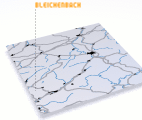 Places with similar names to Bleichenbach, Germany ::
// Bleichenbach (DE)
Disclaimer :: Information on this page comes without warranty of any kind |
||
|
Where is Bleichenbach? Elevation and coordinates ::
Latitude (lat): 50°20'0"N Longitude (lon): 9°3'0"E
Elevation (approx.): 165m (map arrows pan, magnifying glasses zoom) |
||
|
Visiting Bleichenbach? Hotel/Accommodation ::
Book a hotel in Bleichenbach Travel Guide ::
Buy a travel guide for Germany rental cars ::
car rental offers GPS waypoint ::
download a GPX waypoint (PoI) of Bleichenbach for your GPS receiver
|
||