|
search place name
|
||
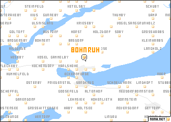
Böhnrüh (Schleswig-Holstein, Germany)Böhnrüh is a town in the Schleswig-Holstein region of Germany. An overview map of the region around Böhnrüh is displayed below.
regional and 3d topo map of Böhnrüh, Germany ::
Böhnrüh airports ::
The nearest airport is KEL - Kiel Holtenau, located 23.4 km south east of Böhnrüh.
Other airports nearby include SGD - Soenderborg Sonderborg (51.8 km north), SKS - Skrydstrup (89.1 km north west), LBC - Luebeck Lubeck Blankensee (95.9 km south east), HAM - Hamburg (97.2 km south), Nearby towns ::
Barkelsby (1.1km west) //
Borby (1.9km south) //
Louisenberg (2.1km south east) //
Vorstadt Steindamm (2.1km south west) //
Karlshöhe (2.8km south west) //
Loose (2.8km north east) //
Losau (2.8km north east) //
Basdorf (3.9km north) //
Eckernförde (3.9km south) //
Rieseby (4.3km north west) //
Windeby (4.3km south west) //
Sandkrug (5.6km south) //
Klein Gammelby (3.2km west) //
Gammelby (3.2km west) //
Hörst (5.7km north) //
Marienthal (5.7km south) //
Holzdorf (6.0km north) //
Sönderby (4.9km north west) //
Krieseby (7.4km north) //
Altenhof (7.5km south) //
Zimmert (7.5km north) //
Norby (6.4km north west) //
Friedenstal (6.4km south west) //
Goosefeld (7.7km south) //
Büstorf (7.0km north west) //
Schnellmark (7.0km south east) //
Söby (7.0km north east) //
Seeholz (8.1km north east) //
[all distances 'as the bird flies' and approximate]  Places with similar names to Böhnrüh, Germany ::
Disclaimer :: Information on this page comes without warranty of any kind |
||
|
Where is Böhnrüh? Elevation and coordinates ::
Latitude (lat): 54°30'0"N Longitude (lon): 9°51'0"E
Elevation (approx.): 33m (map arrows pan, magnifying glasses zoom) |
||
|
Visiting Böhnrüh? Hotel/Accommodation ::
Book a hotel in Böhnrüh Travel Guide ::
Buy a travel guide for Germany rental cars ::
car rental offers GPS waypoint ::
download a GPX waypoint (PoI) of Böhnrüh for your GPS receiver
|
||