|
search place name
|
||
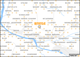
Brande (Niedersachsen, Germany)Brande is a town in the Niedersachsen region of Germany. An overview map of the region around Brande is displayed below.
regional and 3d topo map of Brande, Germany ::
Brande airports ::
The nearest airport is BRE - Bremen, located 20.9 km south east of Brande.
Other airports nearby include BRV - Bremerhaven (32.7 km north), WVN - Wilhelmshaven Mariensiel (51.1 km north west), XFW - Hamburg Finkenwerder (86.6 km north east), EME - Emden (96.8 km west), Nearby towns ::
Brundorf (1.9km north) //
Hahle (1.9km north) //
Leuchtenburg (1.9km south) //
Hünertshagen (1.9km south) //
Habichthorst (1.1km east) //
Hohehorst (1.1km west) //
Eggestedt (2.2km north west) //
Löhnhorst (2.2km south west) //
Kreienmoor (2.2km west) //
Karlshorst (2.9km north east) //
Kerkhop (2.9km north west) //
Bentloge (2.9km south east) //
Wollah (2.9km south east) //
Holthorst (3.9km south) //
Aumund (3.9km south) //
Metjensande (4.3km north east) //
Hamfehr (4.3km north west) //
Schukamp (4.3km north west) //
Platjenwerbe (4.3km south east) //
Im Hagen (4.3km south east) //
Grohn (5.6km south) //
Wölpsche (3.3km west) //
Trenthöpen (3.3km west) //
Lilkendey (3.8km north east) //
Schwanewede (3.8km north west) //
Stillhorn (3.8km north west) //
Heidkamp (3.8km north west) //
Stendorf (3.8km south east) //
Im Strenge (3.8km south east) //
[all distances 'as the bird flies' and approximate]  Places with similar names to Brande, Germany ::
Disclaimer :: Information on this page comes without warranty of any kind |
||
|
Where is Brande? Elevation and coordinates ::
Latitude (lat): 53°13'0"N Longitude (lon): 8°39'0"E
Elevation (approx.): 38m (map arrows pan, magnifying glasses zoom) |
||
|
Visiting Brande? Hotel/Accommodation ::
Book a hotel in Brande Travel Guide ::
Buy a travel guide for Germany rental cars ::
car rental offers GPS waypoint ::
download a GPX waypoint (PoI) of Brande for your GPS receiver
|
||