|
search place name
|
||
Clef (Nordrhein-Westfalen, Germany)Clef is a town in the Nordrhein-Westfalen region of Germany. An overview map of the region around Clef is displayed below.
regional and 3d topo map of Clef, Germany ::

Clef airports ::
The nearest airport is CGN - Cologne Koln Bonn, located 14.5 km south west of Clef.
Other airports nearby include DUS - Duesseldorf Dusseldorf (53.1 km north west), ESS - Essen Mulheim (56.4 km north west), MGL - Moenchengladbach Monchengladbach (63.9 km north west), DTM - Dortmund (66.9 km north), Nearby towns ::
Overath (0.0km north) //
Rott (0.0km north) //
Hohkeppel (1.9km north) //
Bengelshöhe (1.9km north) //
Meesbalken (1.2km west) //
Rittberg (1.9km south) //
Burg (1.9km south) //
Vilkerath (2.2km north east) //
Marialinden (2.2km south east) //
Höhe (2.2km south east) //
Rappenhohn (2.2km south west) //
Breidenassel (2.2km south east) //
Müllemich (3.7km north) //
Oberbergscheid (3.7km north) //
Kotten (2.3km west) //
Viersbrücken (3.7km south) //
Halzemich (3.7km south) //
Schönenborn (3.9km north) //
Holl (3.9km north) //
Köttingen (3.9km north) //
Neuschmitzhöhe (3.9km north) //
Schmitzhöhe (3.9km north) //
Vellingen (3.9km north) //
Böke (3.0km north west) //
Leffelsend (3.0km north west) //
Weberhöhe (3.0km south west) //
Eichen (3.0km south west) //
Großoberscheid (3.0km south east) //
Schiefenthal (3.9km south) //
[all distances 'as the bird flies' and approximate] 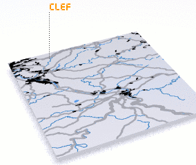 Places with similar names to Clef, Germany ::
Disclaimer :: Information on this page comes without warranty of any kind |
||
|
Where is Clef? Elevation and coordinates ::
Latitude (lat): 50°57'0"N Longitude (lon): 7°18'0"E
Elevation (approx.): 158m (map arrows pan, magnifying glasses zoom) |
||
|
Visiting Clef? Hotel/Accommodation ::
Book a hotel in Clef Travel Guide ::
Buy a travel guide for Germany rental cars ::
car rental offers GPS waypoint ::
download a GPX waypoint (PoI) of Clef for your GPS receiver
|
||