|
search place name
|
||
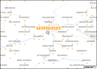
Derendingen (Baden-Württemberg, Germany)Derendingen is a town in the Baden-Württemberg region of Germany. An overview map of the region around Derendingen is displayed below.
regional and 3d topo map of Derendingen, Germany ::
Derendingen airports ::
The nearest airport is STR - Stuttgart, located 24.6 km north east of Derendingen.
Other airports nearby include ZQL - Donaueschingen Villingen (70.5 km south west), ZCC - Baden-baden Baden Oos (71.4 km north west), FDH - Friedrichshafen (98.3 km south), ZQC - Speyer (99.5 km north west), Nearby towns ::
Waldhörnle (1.2km east) //
Weilheim (2.2km south west) //
Tübingen (3.7km north) //
Kilchberg (3.1km south west) //
Hinterweiler (4.4km south east) //
Stockach (4.4km south east) //
Lustnau (4.4km north east) //
Hagelloch (4.4km north west) //
Waldhausen (5.6km north) //
Dußlingen (5.6km south) //
Wankheim (3.7km east) //
Hirschau (3.7km west) //
Bebenhausen (5.7km north) //
Burg (5.7km south) //
Immenhausen (4.1km south east) //
Bühl (4.1km south west) //
Nehren (7.5km south) //
Mähringen (5.3km east) //
Kusterdingen (5.2km east) //
Unterjesingen (5.2km west) //
Gomaringen (7.4km south east) //
Pfrondorf (7.4km north east) //
[all distances 'as the bird flies' and approximate]  Places with similar names to Derendingen, Germany ::
// Derendingen (CH)
// Trontingen (BE)
Disclaimer :: Information on this page comes without warranty of any kind |
||
|
Where is Derendingen? Elevation and coordinates ::
Latitude (lat): 48°30'0"N Longitude (lon): 9°3'0"E
Elevation (approx.): 336m (map arrows pan, magnifying glasses zoom) |
||
|
Visiting Derendingen? Hotel/Accommodation ::
Book a hotel in Derendingen Travel Guide ::
Buy a travel guide for Germany rental cars ::
car rental offers GPS waypoint ::
download a GPX waypoint (PoI) of Derendingen for your GPS receiver
|
||