|
search place name
|
||
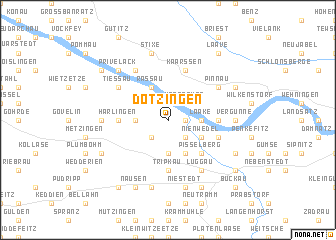
Dötzingen (Niedersachsen, Germany)Dötzingen is a town in the Niedersachsen region of Germany. An overview map of the region around Dötzingen is displayed below.
regional and 3d topo map of Dötzingen, Germany ::
Dötzingen airports ::
The nearest airport is SZW - Schwerin Parchim, located 58.8 km north east of Dötzingen.
Other airports nearby include LBC - Luebeck Lubeck Blankensee (75.9 km north), HAM - Hamburg (87.7 km north west), XFW - Hamburg Finkenwerder (90.5 km north west), ZCN - Celle (92.2 km south west), Nearby towns ::
Hitzacker (1.1km east) //
Neu Dötzingen (1.1km east) //
Marwedel (1.1km east) //
Bitter (1.9km north) //
Sarenseck (2.2km south west) //
Herrenhof (2.2km north east) //
Seerau (2.2km south east) //
Riskau (3.7km south) //
Sarchem (2.2km west) //
Brandstade (2.2km east) //
Laake (2.2km east) //
Rassau (3.9km north) //
Prilipp (3.9km north) //
Kähmen (3.9km south) //
Nienwedel (2.9km south east) //
Pisselberg (4.3km south east) //
Streetz (4.3km south east) //
Tripkau (5.6km south) //
Thunpadel (5.6km south) //
Gosewerder (3.3km east) //
Pussade (3.3km west) //
Harlingen (3.3km west) //
Wussegel (3.8km south east) //
Grabau (3.8km south east) //
Kaarßen (5.7km north) //
Pinnau (5.0km north east) //
Tiesmesland (5.0km north west) //
Tießau (5.0km north west) //
Banke (6.0km north) //
[all distances 'as the bird flies' and approximate] 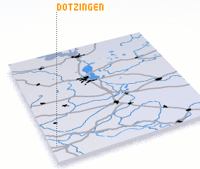
Disclaimer :: Information on this page comes without warranty of any kind |
||
|
Where is Dötzingen? Elevation and coordinates ::
Latitude (lat): 53°9'0"N Longitude (lon): 11°2'0"E
Elevation (approx.): 22m (map arrows pan, magnifying glasses zoom) |
||
|
Visiting Dötzingen? Hotel/Accommodation ::
Book a hotel in Dötzingen Travel Guide ::
Buy a travel guide for Germany rental cars ::
car rental offers GPS waypoint ::
download a GPX waypoint (PoI) of Dötzingen for your GPS receiver
|
||