|
search place name
|
||
Eigeltingen (Baden-Württemberg, Germany)Eigeltingen is a town in the Baden-Württemberg region of Germany. An overview map of the region around Eigeltingen is displayed below.
regional and 3d topo map of Eigeltingen, Germany ::

Eigeltingen airports ::
The nearest airport is ZQL - Donaueschingen Villingen, located 30.6 km north west of Eigeltingen.
Other airports nearby include FDH - Friedrichshafen (50.7 km south east), ZRH - Zurich (51.9 km south west), ACH - St Gallen Altenrhein (65.3 km south east), STR - Stuttgart (94.6 km north), Nearby towns ::
Reute (1.9km north) //
Hirschlanden (1.2km east) //
Homberg (1.2km east) //
Langenstein (3.7km south) //
Guggenhausen (3.1km north east) //
Eckartsbrunn (3.1km north west) //
Rorgenwies (3.9km north) //
Glashütte (3.9km north) //
Honstetten (3.9km north) //
Wiechs (5.6km south) //
Münchhöf (4.2km north east) //
Aach (4.2km south west) //
Schoren (5.7km south) //
Heudorf (6.1km north east) //
Volkertshausen (6.1km south west) //
Liptingen (7.5km north) //
Emmingen-Liptingen (7.5km north) //
Raithaslach (5.3km east) //
Beuren an der Aach (7.5km south) //
Emmingen ab Egg (6.7km north west) //
Steißlingen (7.8km south) //
Orsingen-Nenzingen (6.2km south east) //
Wahlwies (7.5km south east) //
Schlatt unter Krähen (8.9km south west) //
[all distances 'as the bird flies' and approximate] 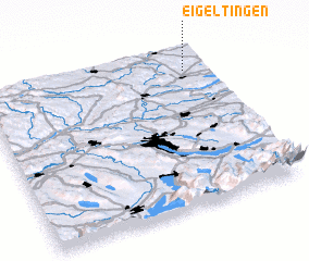 Places with similar names to Eigeltingen, Germany :: Disclaimer :: Information on this page comes without warranty of any kind |
||
|
Where is Eigeltingen? Elevation and coordinates ::
Latitude (lat): 47°52'0"N Longitude (lon): 8°54'0"E
Elevation (approx.): 524m (map arrows pan, magnifying glasses zoom) |
||
|
Visiting Eigeltingen? Hotel/Accommodation ::
Book a hotel in Eigeltingen Travel Guide ::
Buy a travel guide for Germany rental cars ::
car rental offers GPS waypoint ::
download a GPX waypoint (PoI) of Eigeltingen for your GPS receiver
|
||