|
search place name
|
||
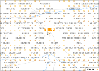
Einöd (Bayern, Germany)Einöd is a town in the Bayern region of Germany. An overview map of the region around Einöd is displayed below.
regional and 3d topo map of Einöd, Germany ::
Einöd airports ::
The nearest airport is SZG - Salzburg, located 61.7 km south of Einöd.
Other airports nearby include MUC - Munich Munchen (76.4 km west), LNZ - Linz (Horsching) (102.3 km east), FEL - Fuerstenfeldbruck Furstenfeldbruck (115.9 km west), OBF - Oberpfaffenhofen (117.4 km west), Nearby towns ::
Reut (0.0km north) //
Hennthal (0.0km north) //
Etzenberg (1.9km south) //
Vorleiten (1.2km west) //
Laimbichl (1.9km north) //
Rigl (1.9km north) //
Gehersdorf (2.2km south east) //
Greinhof (2.2km north east) //
Schmelling (2.2km north west) //
Aicha (2.2km north west) //
Pleining (3.7km south) //
Hickerstall (2.5km west) //
Zeilarn (3.9km south) //
Sulzberg (3.9km south) //
Rogglfing (3.1km north east) //
Ellbrunn (3.9km south) //
Enggrub (3.9km south) //
Untereck (3.1km south west) //
Obereck (3.1km south west) //
Grafing (3.9km north) //
Wurmannsquick (3.1km north west) //
Straßhäuser (3.1km north west) //
Schachten (3.9km north) //
Babing (4.5km south east) //
Kellndorf (4.5km south east) //
Sonnertsham (4.5km south east) //
Erlbach (4.5km south west) //
Martinskirchen (4.5km north east) //
Grasensee (4.5km north east) //
[all distances 'as the bird flies' and approximate]  Places with similar names to Einöd, Germany ::
Disclaimer :: Information on this page comes without warranty of any kind |
||
|
Where is Einöd? Elevation and coordinates ::
Latitude (lat): 48°20'0"N Longitude (lon): 12°49'0"E
Elevation (approx.): 471m (map arrows pan, magnifying glasses zoom) |
||
|
Visiting Einöd? Hotel/Accommodation ::
Book a hotel in Einöd Travel Guide ::
Buy a travel guide for Germany rental cars ::
car rental offers GPS waypoint ::
download a GPX waypoint (PoI) of Einöd for your GPS receiver
|
||