|
search place name
|
||
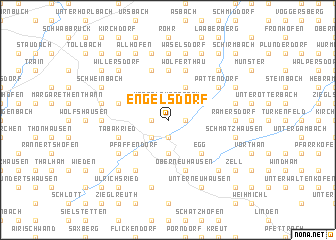
Engelsdorf (Bayern, Germany)Engelsdorf is a town in the Bayern region of Germany. An overview map of the region around Engelsdorf is displayed below.
regional and 3d topo map of Engelsdorf, Germany ::
Engelsdorf airports ::
The nearest airport is MUC - Munich Munchen, located 39.0 km south of Engelsdorf.
Other airports nearby include FEL - Fuerstenfeldbruck Furstenfeldbruck (74.2 km south west), AGB - Augsburg (81.6 km west), OBF - Oberpfaffenhofen (83.9 km south west), NUE - Nuernberg Nurnberg (112.0 km north west), Nearby towns ::
Hintlaber (1.9km south) //
Hackendorf (1.2km east) //
Pfeffenhausen (1.9km south) //
Ebenhausen (1.2km west) //
Unterlauterbach (1.9km north) //
Egglhausen (2.2km south west) //
Oberlauterbach (2.2km north west) //
Baldershausen (2.2km north west) //
Holzhausen (3.7km south) //
Oberhatzkofen (3.1km north east) //
Bogenhausen (3.1km north east) //
Niederhatzkofen (3.1km north east) //
Haag (3.9km north) //
Dürnwind (4.4km south east) //
Egg (4.4km south east) //
Leitendorf (4.4km south west) //
Pfaffendorf (4.4km south west) //
Oberbuch (5.6km north) //
Wolferthau (5.7km north) //
Tabakried (4.1km south west) //
Oberneuhausen (5.7km south) //
Gressau (5.7km north) //
Thonhausen (4.1km north west) //
Koppenwall (5.2km south west) //
Gisseltshausen (5.2km north east) //
Pattendorf (5.2km north east) //
Lutzmannsdorf (6.1km south west) //
Eschenloh (4.9km east) //
Ramersdorf (4.9km east) //
[all distances 'as the bird flies' and approximate]  Places with similar names to Engelsdorf, Germany ::
// Engelsdorf (AT)
// Engelsdorf (AT)
// Engelsdorf (AT)
// Engelsdorf (AT)
// Engelsdorf (DE)
// Engelsdorf (DE)
// Engelsdorf (DE)
// Engelsdorf (DE)
// Engelsdorf (DE)
// Engelsdorf (DE)
Disclaimer :: Information on this page comes without warranty of any kind |
||
|
Where is Engelsdorf? Elevation and coordinates ::
Latitude (lat): 48°41'0"N Longitude (lon): 11°58'0"E
Elevation (approx.): 468m (map arrows pan, magnifying glasses zoom) |
||
|
Visiting Engelsdorf? Hotel/Accommodation ::
Book a hotel in Engelsdorf Travel Guide ::
Buy a travel guide for Germany rental cars ::
car rental offers GPS waypoint ::
download a GPX waypoint (PoI) of Engelsdorf for your GPS receiver
|
||