|
search place name
|
||
Erda (Hessen, Germany)Erda is a town in the Hessen region of Germany. An overview map of the region around Erda is displayed below.
regional and 3d topo map of Erda, Germany ::

Erda airports ::
The nearest airport is ZNF - Hanau Aaf, located 63.7 km south east of Erda.
Other airports nearby include FRA - Frankfurt Main (71.2 km south), ZNV - Koblenz Winningen (79.7 km south west), CGN - Cologne Koln Bonn (99.4 km west), ZCA - Arnsberg Menden (100.6 km north west), Nearby towns ::
Großaltenstädten (1.2km west) //
Hohensolms (1.9km south) //
Königsberg (2.2km south east) //
Wilsbach (3.9km north) //
Roßbach (3.9km north) //
Mudersbach (3.0km north west) //
Niederweidbach (4.4km north west) //
Blasbach (5.6km south) //
Frankenbach (3.5km east) //
Ahrdt (5.1km north west) //
Oberweidbach (7.4km north) //
Altenkirchen (5.1km west) //
Bermoll (5.1km west) //
Rodenhausen (6.6km north east) //
Bieber (6.0km south east) //
Bischoffen (6.0km north west) //
Bechlingen (6.0km south west) //
Seelbach (7.3km north east) //
Vetzberg (7.3km south east) //
Aßlar (8.2km south west) //
[all distances 'as the bird flies' and approximate] 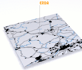 Places with similar names to Erda, Germany ::
Disclaimer :: Information on this page comes without warranty of any kind |
||
|
Where is Erda? Elevation and coordinates ::
Latitude (lat): 50°40'0"N Longitude (lon): 8°31'0"E
Elevation (approx.): 320m (map arrows pan, magnifying glasses zoom) |
||
|
Visiting Erda? Hotel/Accommodation ::
Book a hotel in Erda Travel Guide ::
Buy a travel guide for Germany rental cars ::
car rental offers GPS waypoint ::
download a GPX waypoint (PoI) of Erda for your GPS receiver
|
||