|
search place name
|
||
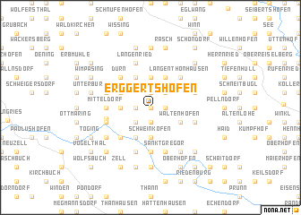
Erggertshofen (Bayern, Germany)Erggertshofen is a town in the Bayern region of Germany. An overview map of the region around Erggertshofen is displayed below.
regional and 3d topo map of Erggertshofen, Germany ::
Erggertshofen airports ::
The nearest airport is NUE - Nuernberg Nurnberg, located 64.7 km north west of Erggertshofen.
Other airports nearby include MUC - Munich Munchen (78.2 km south), AGB - Augsburg (86.6 km south west), FEL - Fuerstenfeldbruck Furstenfeldbruck (97.7 km south), BYU - Bayreuth (103.9 km north), Nearby towns ::
Predlfing (0.0km north) //
Haahof (1.2km west) //
Parleithen (1.2km west) //
Pestenrain (1.9km south) //
Eutenhofen (1.2km east) //
Siegertshofen (1.9km north) //
Wildenstein (2.2km south west) //
Wolfertshofen (2.2km north east) //
Leiterzhofen (2.2km north east) //
Schweinkofen (3.7km south) //
Haas (2.4km west) //
Breitenegg (3.7km north) //
Mühlbach (3.9km south) //
Breitenbrunn (3.9km north) //
Premerzhofen (3.1km north west) //
Eismannsdorf (3.1km north west) //
Buch (3.9km north) //
Waltenhofen (3.1km south east) //
Gundelshofen (3.1km south east) //
Albertshofen (3.1km south east) //
Einsiedel (4.4km south west) //
Dürn (4.4km north west) //
Langenthonhausen (4.4km north east) //
Meihern (5.6km south) //
Hainsberg (3.6km west) //
Mitteldorf (3.6km west) //
Dietfurt (3.9km west) //
Blauhof (5.7km south) //
Langenried (5.7km north) //
[all distances 'as the bird flies' and approximate]  Places with similar names to Erggertshofen, Germany ::
// Erkertshofen (DE)
Disclaimer :: Information on this page comes without warranty of any kind |
||
|
Where is Erggertshofen? Elevation and coordinates ::
Latitude (lat): 49°3'0"N Longitude (lon): 11°38'0"E
Elevation (approx.): 484m (map arrows pan, magnifying glasses zoom) |
||
|
Visiting Erggertshofen? Hotel/Accommodation ::
Book a hotel in Erggertshofen Travel Guide ::
Buy a travel guide for Germany rental cars ::
car rental offers GPS waypoint ::
download a GPX waypoint (PoI) of Erggertshofen for your GPS receiver
|
||