|
search place name
|
||
Erlkam (Bayern, Germany)Erlkam is a town in the Bayern region of Germany. An overview map of the region around Erlkam is displayed below.
regional and 3d topo map of Erlkam, Germany ::

Erlkam airports ::
The nearest airport is OBF - Oberpfaffenhofen, located 37.1 km north west of Erlkam.
Other airports nearby include FEL - Fuerstenfeldbruck Furstenfeldbruck (46.9 km north west), MUC - Munich Munchen (50.9 km north), INN - Innsbruck (76.0 km south), AGB - Augsburg (81.7 km north west), Nearby towns ::
Heignkam (0.0km north) //
Föching (1.2km east) //
Holzham (1.2km west) //
Holzkirchen (1.9km south) //
Otterfing (2.2km north west) //
Inselkam (2.2km south west) //
Haid (2.2km south west) //
Thann (3.7km south) //
Bergham (2.5km west) //
Palnkam (2.5km west) //
Fellach (2.5km east) //
Marschall (3.9km south) //
Lochham (3.9km south) //
Roggersdorf (3.1km south west) //
Draxlham (4.5km south east) //
Oberlaindern (4.5km south east) //
Sufferloh (5.6km south) //
Erlach (3.7km west) //
Großhartpenning (5.7km south) //
Wettlkam (4.2km north west) //
Heigenkam (4.2km north west) //
Unterlaindern (4.2km south east) //
Kreuzstraße (4.2km north east) //
Buch (6.1km south west) //
Asberg (6.1km south west) //
Kleinhartpenning (6.1km south west) //
Arget (5.3km north west) //
Jasberg (5.0km west) //
Steingau (5.0km west) //
[all distances 'as the bird flies' and approximate] 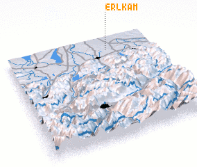 Places with similar names to Erlkam, Germany ::
// Erlecom (NL)
Disclaimer :: Information on this page comes without warranty of any kind |
||
|
Where is Erlkam? Elevation and coordinates ::
Latitude (lat): 47°54'0"N Longitude (lon): 11°42'0"E
Elevation (approx.): 667m (map arrows pan, magnifying glasses zoom) |
||
|
Visiting Erlkam? Hotel/Accommodation ::
Book a hotel in Erlkam Travel Guide ::
Buy a travel guide for Germany rental cars ::
car rental offers GPS waypoint ::
download a GPX waypoint (PoI) of Erlkam for your GPS receiver
|
||