|
search place name
|
||
Ersdorf (Nordrhein-Westfalen, Germany)Ersdorf is a town in the Nordrhein-Westfalen region of Germany. An overview map of the region around Ersdorf is displayed below.
regional and 3d topo map of Ersdorf, Germany ::

Ersdorf airports ::
The nearest airport is CGN - Cologne Koln Bonn, located 31.3 km north of Ersdorf.
Other airports nearby include ZNV - Koblenz Winningen (48.4 km south east), SPM - Spangdahlem Ab (73.1 km south), HHN - Frankfurt Hahn (74.9 km south), MGL - Moenchengladbach Monchengladbach (78.3 km north west), Nearby towns ::
Ipplendorf (0.0km north) //
Altendorf (1.2km east) //
Klein Altendorf (1.9km north) //
Wormersdorf (2.2km north west) //
Meckenheim (3.9km north) //
Gelsdorf (3.0km south east) //
Oberesch (3.9km south) //
Ramershoven (4.4km north west) //
Hilberath (4.4km south west) //
Lüftelberg (5.6km north) //
Kalenborn (5.6km south) //
Flerzheim (5.7km north) //
Todenfeld (4.0km south west) //
Rheinbach (5.1km north west) //
Merl (5.1km north east) //
Oberholzweiler (5.1km south east) //
Vettelhoven (5.1km south east) //
Niederholzweiler (5.1km south east) //
Niederesch (6.0km south east) //
Esch (6.0km south east) //
Eckendorf (4.7km east) //
Irlenbusch (4.7km west) //
Merzbach (4.7km west) //
Mayschoß (7.5km south) //
Adendorf (5.1km east) //
Neukirchen (5.1km west) //
Peppenhoven (6.6km north west) //
Berg (6.6km south west) //
Holzweiler (6.6km south east) //
[all distances 'as the bird flies' and approximate] 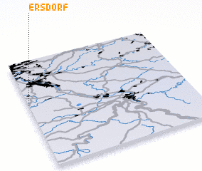 Places with similar names to Ersdorf, Germany ::
Disclaimer :: Information on this page comes without warranty of any kind |
||
|
Where is Ersdorf? Elevation and coordinates ::
Latitude (lat): 50°36'0"N Longitude (lon): 7°0'0"E
Elevation (approx.): 211m (map arrows pan, magnifying glasses zoom) |
||
|
Visiting Ersdorf? Hotel/Accommodation ::
Book a hotel in Ersdorf Travel Guide ::
Buy a travel guide for Germany rental cars ::
car rental offers GPS waypoint ::
download a GPX waypoint (PoI) of Ersdorf for your GPS receiver
|
||