|
search place name
|
||
Fankel (Rheinland-Pfalz, Germany)Fankel is a town in the Rheinland-Pfalz region of Germany. An overview map of the region around Fankel is displayed below.
regional and 3d topo map of Fankel, Germany ::

Fankel airports ::
The nearest airport is HHN - Frankfurt Hahn, located 20.7 km south of Fankel.
Other airports nearby include ZNV - Koblenz Winningen (30.0 km north east), SPM - Spangdahlem Ab (42.7 km south west), ZQF - Trier Fohren (43.8 km south west), CGN - Cologne Koln Bonn (81.7 km north), Nearby towns ::
Bruttig (0.0km north) //
Bruttig-Fankel (0.0km north) //
Ellenz (1.9km south) //
Ernst (1.9km north) //
Poltersdorf (2.2km south west) //
Beilstein (2.2km south east) //
Valwigerberg (2.2km north west) //
Valwig (2.2km north west) //
Ellenz-Poltersdorf (3.7km south) //
Ebernach (2.4km west) //
Briedern (4.4km south west) //
Mesenich (4.4km south west) //
Klotten (4.4km north west) //
Sehl (3.6km west) //
Engelport (3.6km east) //
Kail (5.6km north) //
Senheim (5.7km south) //
Senhals (6.0km south west) //
Nehren (6.0km south west) //
Pommern (5.1km north east) //
Brieden (6.0km north east) //
Grenderich (7.4km south) //
Hahnenstein (5.1km west) //
Binningen (7.5km north) //
Mittelstrimmig (6.6km south east) //
Liesenich (6.6km south east) //
Ediger (6.0km south west) //
Altstrimmig (6.0km south east) //
Wirfus (7.8km north) //
[all distances 'as the bird flies' and approximate] 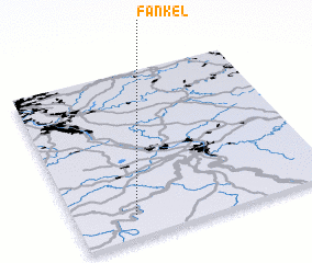 Places with similar names to Fankel, Germany ::
Disclaimer :: Information on this page comes without warranty of any kind |
||
|
Where is Fankel? Elevation and coordinates ::
Latitude (lat): 50°8'0"N Longitude (lon): 7°14'0"E
Elevation (approx.): 98m (map arrows pan, magnifying glasses zoom) |
||
|
Visiting Fankel? Hotel/Accommodation ::
Book a hotel in Fankel Travel Guide ::
Buy a travel guide for Germany rental cars ::
car rental offers GPS waypoint ::
download a GPX waypoint (PoI) of Fankel for your GPS receiver
|
||