|
search place name
|
||
Flamersheim (Nordrhein-Westfalen, Germany)Flamersheim is a town in the Nordrhein-Westfalen region of Germany. An overview map of the region around Flamersheim is displayed below.
regional and 3d topo map of Flamersheim, Germany ::

Flamersheim airports ::
The nearest airport is CGN - Cologne Koln Bonn, located 34.6 km north east of Flamersheim.
Other airports nearby include ZNV - Koblenz Winningen (58.1 km south east), GKE - Geilenkirchen (68.6 km north west), MGL - Moenchengladbach Monchengladbach (72.5 km north), SPM - Spangdahlem Ab (72.5 km south), Nearby towns ::
Niederkastenholz (1.2km west) //
Schweinheim (1.2km east) //
Oberkastenholz (1.2km west) //
Palmersheim (2.2km north east) //
Hockenbroich (2.2km south west) //
Kirchheim (2.2km south west) //
Stotzheim (3.0km north west) //
Kuchenheim (3.9km north) //
Essig (4.4km north east) //
Odendorf (4.4km north east) //
Rheder (3.5km west) //
Kreuzweingarten (3.5km west) //
Weidesheim (5.7km north) //
Kirspenich (4.0km south west) //
Queckenberg (4.0km south east) //
Loch (4.0km south east) //
Roitzheim (5.1km north west) //
Sürst (5.1km south east) //
Kleinbüllesheim (7.5km north) //
Dom-Esch (7.5km north) //
Billig (5.1km west) //
Oberdrees (5.1km east) //
Arloff (5.1km west) //
Groß Schlebach (5.1km east) //
Ludendorf (6.6km north east) //
Scheuren (6.6km south east) //
Großbüllesheim (7.8km north) //
Ollheim (7.8km north) //
Mömerzheim (7.8km north) //
[all distances 'as the bird flies' and approximate] 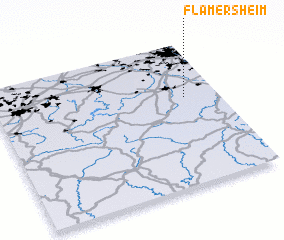 Places with similar names to Flamersheim, Germany ::
// Flomersheim (DE)
Disclaimer :: Information on this page comes without warranty of any kind |
||
|
Where is Flamersheim? Elevation and coordinates ::
Latitude (lat): 50°37'0"N Longitude (lon): 6°51'0"E
Elevation (approx.): 206m (map arrows pan, magnifying glasses zoom) |
||
|
Visiting Flamersheim? Hotel/Accommodation ::
Book a hotel in Flamersheim Travel Guide ::
Buy a travel guide for Germany rental cars ::
car rental offers GPS waypoint ::
download a GPX waypoint (PoI) of Flamersheim for your GPS receiver
|
||