|
search place name
|
||
Freiolsheim (Baden-Württemberg, Germany)Freiolsheim is a town in the Baden-Württemberg region of Germany. An overview map of the region around Freiolsheim is displayed below.
regional and 3d topo map of Freiolsheim, Germany ::

Freiolsheim airports ::
The nearest airport is ZCC - Baden-baden Baden Oos, located 15.8 km south west of Freiolsheim.
Other airports nearby include ZQC - Speyer (50.6 km north), STR - Stuttgart (64.2 km east), SXB - Strassbourg Entzheim (65.5 km south west), MHG - Mannheim City (69.9 km north), Nearby towns ::
Mittelberg (1.2km east) //
Moosbronn (2.2km south east) //
Völkersbach (2.2km north east) //
Bernbach (2.2km south east) //
Michelbach (4.4km south west) //
Sulzbach (5.7km north) //
Sulzbach (5.7km south) //
Schluttenbach (5.7km north) //
Frauenalb (4.1km south east) //
Burbach (4.1km north east) //
Waldprechtsweier (4.1km north west) //
Malsch (5.2km north west) //
Schöllbronn (6.1km north east) //
Oberweier (7.4km north) //
Winkel (5.2km west) //
Schielberg (5.2km east) //
Bad Herrenalb (6.7km south east) //
Kullenmühle (6.7km south east) //
Gaggenau (6.7km south west) //
Ottenau (6.7km south west) //
Hörden (7.8km south) //
Spessart (8.3km north east) //
Bleiche (7.4km south east) //
Selbach (8.9km south west) //
Kepplershof (8.9km south east) //
Aschenhütte (8.9km south east) //
[all distances 'as the bird flies' and approximate] 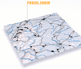 Places with similar names to Freiolsheim, Germany ::
// Frilsham (GB)
Disclaimer :: Information on this page comes without warranty of any kind |
||
|
Where is Freiolsheim? Elevation and coordinates ::
Latitude (lat): 48°51'0"N Longitude (lon): 8°23'0"E
Elevation (approx.): 477m (map arrows pan, magnifying glasses zoom) |
||
|
Visiting Freiolsheim? Hotel/Accommodation ::
Book a hotel in Freiolsheim Travel Guide ::
Buy a travel guide for Germany rental cars ::
car rental offers GPS waypoint ::
download a GPX waypoint (PoI) of Freiolsheim for your GPS receiver
|
||