|
search place name
|
||
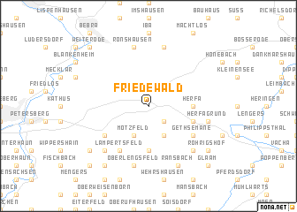
Friedewald (Hessen, Germany)Friedewald is a town in the Hessen region of Germany. An overview map of the region around Friedewald is displayed below.
regional and 3d topo map of Friedewald, Germany ::
Friedewald airports ::
The nearest airport is KSF - Kassel Calden, located 67.7 km north west of Friedewald.
Other airports nearby include ERF - Erfurt (77.5 km east), ZNF - Hanau Aaf (102.1 km south west), PAD - Paderborn Lippstadt (119.3 km north west), FRA - Frankfurt Main (133.9 km south west), Nearby towns ::
Lautenhausen (2.2km south east) //
Hillartshausen (3.9km south) //
Motzfeld (3.9km south) //
Hilmes (5.6km south) //
Herfa (3.5km east) //
Unterneurode (4.0km south east) //
Malkomes (5.1km south west) //
Gethsemane (5.1km south east) //
Lampertsfeld (6.0km south west) //
Herfagrund (5.0km east) //
Oberlengsfeld (7.5km south) //
Schenklengsfeld (7.5km south) //
Ziebach (7.5km north) //
Ronshausen (7.5km north) //
Schenksolz (6.6km south west) //
Ausbach (6.6km south east) //
Ransbach (7.8km south) //
Konrode (8.2km south west) //
Röhrigshof (7.3km south east) //
Dinkelrode (7.3km south west) //
Glaam (8.8km south east) //
Wüstfeld (8.8km south west) //
Weiterode (8.8km north west) //
[all distances 'as the bird flies' and approximate]  Places with similar names to Friedewald, Germany ::
Disclaimer :: Information on this page comes without warranty of any kind |
||
|
Where is Friedewald? Elevation and coordinates ::
Latitude (lat): 50°53'0"N Longitude (lon): 9°52'0"E
Elevation (approx.): 389m (map arrows pan, magnifying glasses zoom) |
||
|
Visiting Friedewald? Hotel/Accommodation ::
Book a hotel in Friedewald Travel Guide ::
Buy a travel guide for Germany rental cars ::
car rental offers GPS waypoint ::
download a GPX waypoint (PoI) of Friedewald for your GPS receiver
|
||