|
search place name
|
||
Gehau (Hessen, Germany)Gehau is a town in the Hessen region of Germany. An overview map of the region around Gehau is displayed below.
regional and 3d topo map of Gehau, Germany ::

Gehau airports ::
The nearest airport is KSF - Kassel Calden, located 71.7 km north of Gehau.
Other airports nearby include ZNF - Hanau Aaf (75.5 km south west), FRA - Frankfurt Main (105.3 km south west), ERF - Erfurt (107.6 km east), PAD - Paderborn Lippstadt (111.5 km north west), Nearby towns ::
Grebenau (1.9km south) //
Wallersdorf (2.2km south east) //
Machtlos (3.9km north) //
Hatterode (3.0km south east) //
Reimenrod (3.0km south west) //
Bieben (3.0km south west) //
Eulersdorf (3.9km south) //
Breitenbach am Herzberg (3.5km east) //
Ibra (5.7km north) //
Udenhausen (5.7km south) //
Weißenborn (6.0km north west) //
Hausen (7.5km north) //
Lingelbach (5.0km west) //
Görzhain (6.6km north west) //
Kemmerode (6.6km north east) //
Schwarz (6.6km south west) //
Reimboldshausen (7.3km north east) //
Allendorf (8.8km north east) //
Schorbach (8.8km north west) //
Sassen (8.8km south east) //
[all distances 'as the bird flies' and approximate] 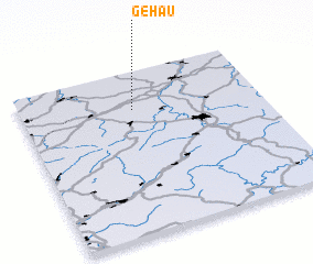 Places with similar names to Gehau, Germany ::
Disclaimer :: Information on this page comes without warranty of any kind |
||
|
Where is Gehau? Elevation and coordinates ::
Latitude (lat): 50°46'0"N Longitude (lon): 9°28'0"E
Elevation (approx.): 407m (map arrows pan, magnifying glasses zoom) |
||
|
Visiting Gehau? Hotel/Accommodation ::
Book a hotel in Gehau Travel Guide ::
Buy a travel guide for Germany rental cars ::
car rental offers GPS waypoint ::
download a GPX waypoint (PoI) of Gehau for your GPS receiver
|
||