|
search place name
|
||
Groß Schönfeld (Mecklenburg-Vorpommern, Germany)Groß Schönfeld is a town in the Mecklenburg-Vorpommern region of Germany. An overview map of the region around Groß Schönfeld is displayed below.
regional and 3d topo map of Groß Schönfeld, Germany ::

Groß Schönfeld airports ::
The nearest airport is RLG - Laage, located 88.4 km north west of Groß Schönfeld.
Other airports nearby include TXL - Berlin Tegel (91.7 km south), SZW - Schwerin Parchim (98.8 km west), THF - Berlin Tempelhof (101.7 km south), SZZ - Szczechin Goleniow (110.9 km east), Nearby towns ::
Hoffelde (1.1km east) //
Georgenhof (2.2km south west) //
Friedrichsfelde (2.2km north east) //
Blankensee (3.7km north) //
Bergfeld (3.9km south) //
Carpin (3.9km south) //
Rödlin (2.9km north west) //
Wanzka (4.3km north west) //
Ollendorf (3.8km south east) //
Watzkendorf (3.8km north east) //
Grünow (5.0km south east) //
Cammin (6.0km north) //
Warbende (5.0km north east) //
Goldenbaum (7.5km south) //
Flatow (4.8km north east) //
Godenswege (7.5km north) //
Rollenhagen (4.8km north west) //
Ballwitz (7.5km north) //
Neuhof (7.1km north west) //
Wutschendorf (8.6km south west) //
Riepke (8.6km north east) //
[all distances 'as the bird flies' and approximate] 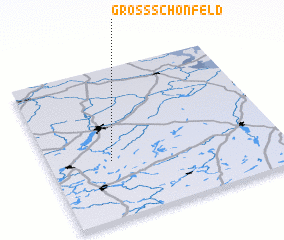 Places with similar names to Groß Schönfeld, Germany :: Disclaimer :: Information on this page comes without warranty of any kind |
||
|
Where is Groß Schönfeld? Elevation and coordinates ::
Latitude (lat): 53°23'0"N Longitude (lon): 13°16'0"E
Elevation (approx.): 77m (map arrows pan, magnifying glasses zoom) |
||
|
Visiting Groß Schönfeld? Hotel/Accommodation ::
Book a hotel in Groß Schönfeld Travel Guide ::
Buy a travel guide for Germany rental cars ::
car rental offers GPS waypoint ::
download a GPX waypoint (PoI) of Groß Schönfeld for your GPS receiver
|
||