|
search place name
|
||
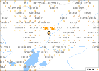
Gründl (Bayern, Germany)Gründl is a town in the Bayern region of Germany. An overview map of the region around Gründl is displayed below.
regional and 3d topo map of Gründl, Germany ::
Gründl airports ::
The nearest airport is OBF - Oberpfaffenhofen, located 55.7 km north east of Gründl.
Other airports nearby include INN - Innsbruck (63.8 km south east), FEL - Fuerstenfeldbruck Furstenfeldbruck (66.2 km north east), AGB - Augsburg (81.2 km north), ACH - St Gallen Altenrhein (96.2 km west), Nearby towns ::
Grubweidach (0.0km north) //
Lechbruck (0.0km north) //
Bichel (0.0km north) //
Karlsebene (1.2km east) //
Vordergründl (1.2km east) //
Prem (1.9km south) //
Falchen (1.9km south) //
Voglegg (2.2km north west) //
Echerschwang (2.2km north west) //
Unterried (2.2km south east) //
Helmenstein (2.2km south west) //
Steingädele (2.5km east) //
Urspring (2.5km east) //
Klausmen (2.5km west) //
Bernbeuren (3.9km north) //
Ried (3.9km north) //
Gruiwang (3.9km north) //
Illach (3.1km north east) //
Loxhub (3.1km north west) //
Hafegg (3.1km north west) //
Moosreiten (3.9km south) //
Straß (4.5km north west) //
Kögel (4.5km south west) //
Sandgraben (3.7km east) //
Hinterholz (3.7km west) //
Haslach (5.7km north) //
Eschach (4.2km north west) //
Reitersau (4.2km south east) //
Thal (5.7km south) //
[all distances 'as the bird flies' and approximate]  Places with similar names to Gründl, Germany ::
Disclaimer :: Information on this page comes without warranty of any kind |
||
|
Where is Gründl? Elevation and coordinates ::
Latitude (lat): 47°42'0"N Longitude (lon): 10°48'0"E
Elevation (approx.): 728m (map arrows pan, magnifying glasses zoom) |
||
|
Visiting Gründl? Hotel/Accommodation ::
Book a hotel in Gründl Travel Guide ::
Buy a travel guide for Germany rental cars ::
car rental offers GPS waypoint ::
download a GPX waypoint (PoI) of Gründl for your GPS receiver
|
||