|
search place name
|
||
Günthers (Hessen, Germany)Günthers is a town in the Hessen region of Germany. An overview map of the region around Günthers is displayed below.
regional and 3d topo map of Günthers, Germany ::

Günthers airports ::
The nearest airport is ERF - Erfurt, located 77.9 km north east of Günthers.
Other airports nearby include ZNF - Hanau Aaf (90.2 km south west), KSF - Kassel Calden (94.5 km north west), GHF - Giebelstadt Aaf (111.4 km south), FRA - Frankfurt Main (123.8 km south west), Nearby towns ::
Meerswinden (0.0km north) //
Neuswarts (1.2km west) //
Habel (1.9km south) //
Seeleshof (2.2km south west) //
Schlitzenhausen (2.2km north east) //
Sinswinden (2.2km north east) //
Habelgraben (2.2km south east) //
Esbachsgraben (3.7km south) //
Apfelbach (2.4km west) //
Oberrothhof (3.7km north) //
Motzlar (3.7km north) //
Tann (2.4km east) //
Schwarzenborn (3.9km south) //
Lahrbach (3.9km south) //
Neustädtges (3.9km south) //
Walkes (3.0km south west) //
Langwinden (3.9km north) //
Wendershausen (3.0km south east) //
Nüsterrasen (4.4km south west) //
Boxberg (4.4km south west) //
Herdaturm (4.4km south east) //
Neuschwammbach (5.6km south) //
Oberrückersbach (5.6km south) //
Unterrückersbach (5.6km south) //
Dietgeshof (3.5km east) //
Alt Schwambach (5.7km south) //
Schleid (5.7km north) //
Knottenhof (4.0km north east) //
Ketten (4.0km south west) //
[all distances 'as the bird flies' and approximate] 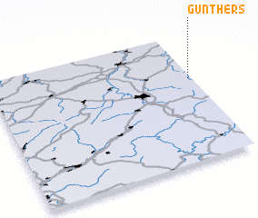 Places with similar names to Günthers, Germany :: Disclaimer :: Information on this page comes without warranty of any kind |
||
|
Where is Günthers? Elevation and coordinates ::
Latitude (lat): 50°39'0"N Longitude (lon): 9°59'0"E
Elevation (approx.): 444m (map arrows pan, magnifying glasses zoom) |
||
|
Visiting Günthers? Hotel/Accommodation ::
Book a hotel in Günthers Travel Guide ::
Buy a travel guide for Germany rental cars ::
car rental offers GPS waypoint ::
download a GPX waypoint (PoI) of Günthers for your GPS receiver
|
||