|
search place name
|
||
Haar (Bayern, Germany)Haar is a town in the Bayern region of Germany. An overview map of the region around Haar is displayed below.
regional and 3d topo map of Haar, Germany ::

Haar airports ::
The nearest airport is LNZ - Linz (Horsching), located 58.4 km south east of Haar.
Other airports nearby include SZG - Salzburg (98.4 km south west), MUC - Munich Munchen (136.5 km west), PRG - Prague Ruzyne (175.5 km north), KLV - Karlovy Vary (186.9 km north), Nearby towns ::
Ederlsdorf (0.0km north) //
Pyrawang (1.9km south) //
Leopoldsdorf (1.2km east) //
Nottau (1.2km east) //
Hundsruck (1.9km north) //
Wörth (1.9km south) //
Hinterhammer (2.2km south west) //
Erlau (2.2km south west) //
Matzenberg (2.2km south east) //
Schergendorf (2.2km north east) //
Grub (2.2km north east) //
Nebling (2.2km north east) //
Winterhof (2.8km south) //
Unterbamberg (3.0km south) //
Oberbamberg (3.5km south) //
Kapfham (2.5km west) //
Leithen (2.5km west) //
Schörgendorf (2.5km west) //
Rothenkreuz (2.5km east) //
Rackling (2.5km east) //
Pisling (3.7km north) //
Petzenberg (3.7km north) //
Haag (3.7km north) //
Wollersbach (3.8km south) //
Dietzendorf (3.5km south west) //
Unterschacher (3.7km south) //
Oberschacher (3.9km south) //
Hub (4.1km south) //
Eckerstampf (3.1km south east) //
[all distances 'as the bird flies' and approximate] 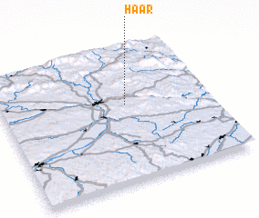 Places with similar names to Haar, Germany ::
Disclaimer :: Information on this page comes without warranty of any kind |
||
|
Where is Haar? Elevation and coordinates ::
Latitude (lat): 48°35'0"N Longitude (lon): 13°36'0"E
Elevation (approx.): 495m (map arrows pan, magnifying glasses zoom) |
||
|
Visiting Haar? Hotel/Accommodation ::
Book a hotel in Haar Travel Guide ::
Buy a travel guide for Germany rental cars ::
car rental offers GPS waypoint ::
download a GPX waypoint (PoI) of Haar for your GPS receiver
|
||