|
search place name
|
||
Hadorf (Bayern, Germany)Hadorf is a town in the Bayern region of Germany. An overview map of the region around Hadorf is displayed below.
regional and 3d topo map of Hadorf, Germany ::

Hadorf airports ::
The nearest airport is OBF - Oberpfaffenhofen, located 7.2 km north of Hadorf.
Other airports nearby include FEL - Fuerstenfeldbruck Furstenfeldbruck (21.1 km north), AGB - Augsburg (52.4 km north west), MUC - Munich Munchen (52.9 km north east), INN - Innsbruck (84.2 km south), Nearby towns ::
Perchting (1.9km south) //
Hanfeld (2.5km east) //
Hochstadt (3.9km north) //
Tiefenbrunn (3.9km north) //
Unering (3.1km north west) //
Mamhofen (3.1km north east) //
Söcking (3.1km south east) //
Maxhof (3.9km south) //
Maising (3.9km south) //
Oberbrunn (4.5km north east) //
Landstetten (4.5km south west) //
Neu Söcking (4.5km south east) //
Drößling (3.7km west) //
Oberpfaffenhofen (5.7km north) //
Pöcking (5.7km south) //
Hausen (5.2km north east) //
Meiling (5.2km north west) //
Weßling (6.1km north west) //
Aschering (6.1km south west) //
Niederpöcking (5.3km south east) //
Possenhofen (6.1km south east) //
Weichselbaum (7.4km north) //
Frieding (5.0km west) //
Oberalting (5.3km west) //
Traubing (7.5km south) //
Wieling (7.5km south) //
Feldafing (7.5km south) //
Starnberg (5.3km east) //
Unterbrunn (6.7km north east) //
[all distances 'as the bird flies' and approximate] 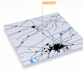 Places with similar names to Hadorf, Germany ::
Disclaimer :: Information on this page comes without warranty of any kind |
||
|
Where is Hadorf? Elevation and coordinates ::
Latitude (lat): 48°1'0"N Longitude (lon): 11°17'0"E
Elevation (approx.): 649m (map arrows pan, magnifying glasses zoom) |
||
|
Visiting Hadorf? Hotel/Accommodation ::
Book a hotel in Hadorf Travel Guide ::
Buy a travel guide for Germany rental cars ::
car rental offers GPS waypoint ::
download a GPX waypoint (PoI) of Hadorf for your GPS receiver
|
||