|
search place name
|
||
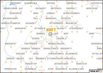
Haft (Baden-Württemberg, Germany)Haft is a town in the Baden-Württemberg region of Germany. An overview map of the region around Haft is displayed below.
regional and 3d topo map of Haft, Germany ::
Haft airports ::
The nearest airport is ZCC - Baden-baden Baden Oos, located 16.5 km north of Haft.
Other airports nearby include SXB - Strassbourg Entzheim (38.1 km west), ZQC - Speyer (76.6 km north), ZQL - Donaueschingen Villingen (81.0 km south), STR - Stuttgart (81.5 km east), Nearby towns ::
Niederhofen (0.0km north) //
Lauf (1.2km east) //
Hundsbosch (1.9km south) //
Kammersbrunn (1.9km south) //
Weier (1.9km north) //
Hub (2.2km north east) //
Matzenhöfe (2.2km south east) //
Obersasbach (2.2km south west) //
Ottersweier (2.2km north west) //
Büchelbach (3.7km south) //
Waldsteg (2.4km east) //
Aspich (2.4km east) //
Gebersberg (2.4km east) //
Oberhatzenweier (3.7km north) //
Hatzenweier (3.7km north) //
Sasbach (2.4km west) //
Sasbachried (2.4km west) //
Sasbachwalden (3.9km south) //
Kappelwindeck (3.9km north) //
Rittersbach (3.9km north) //
Hornenberg (3.1km south east) //
Neusatz (3.1km north east) //
Lautenbächle (3.1km south east) //
Lochwald (3.1km south east) //
Waldmatt (3.1km north east) //
Schugshof (3.1km north east) //
Ottenweier (3.1km north west) //
Walzfeld (3.1km north west) //
Riegel (4.4km north east) //
[all distances 'as the bird flies' and approximate]  Places with similar names to Haft, Germany ::
Disclaimer :: Information on this page comes without warranty of any kind |
||
|
Where is Haft? Elevation and coordinates ::
Latitude (lat): 48°39'0"N Longitude (lon): 8°7'0"E
Elevation (approx.): 169m (map arrows pan, magnifying glasses zoom) |
||
|
Visiting Haft? Hotel/Accommodation ::
Book a hotel in Haft Travel Guide ::
Buy a travel guide for Germany rental cars ::
car rental offers GPS waypoint ::
download a GPX waypoint (PoI) of Haft for your GPS receiver
|
||