|
search place name
|
||
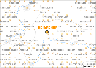
Haiderhöf (Bayern, Germany)Haiderhöf is a town in the Bayern region of Germany. An overview map of the region around Haiderhöf is displayed below.
regional and 3d topo map of Haiderhöf, Germany ::
Haiderhöf airports ::
The nearest airport is NUE - Nuernberg Nurnberg, located 86.3 km west of Haiderhöf.
Other airports nearby include BYU - Bayreuth (92.4 km north west), MUC - Munich Munchen (102.1 km south), HOQ - Hof Plauen (119.8 km north), KLV - Karlovy Vary (120.1 km north east), Nearby towns ::
Eichlgütl (0.0km north) //
Brunn (0.0km north) //
Neubäu (0.0km north) //
Marienthal (1.9km south) //
Lohbügl (1.2km east) //
Fischbach (1.2km east) //
Bachbügl (1.2km east) //
Stefling (2.2km south east) //
Reuting (2.2km north west) //
Hinterberg (3.9km south) //
Hirschling (3.9km south) //
Hof am Regen (3.0km south east) //
Holzheim bei Oder (3.9km north) //
Nerping (3.0km north east) //
Gunt (4.4km south east) //
Ekardsreut (4.4km south east) //
Gibacht (5.6km south) //
Tiefenhof (3.6km east) //
Kaspeltshub (3.6km east) //
Steinberg (5.6km north) //
Heilinghausen (5.7km south) //
Neuhaus (4.1km south east) //
Öd (4.1km south east) //
Oder (5.7km north) //
Jobsthof (5.7km north) //
Loisnitz (4.1km north west) //
Glashütte (4.1km north west) //
Heselbach (5.7km north) //
Hirmerhaus (5.7km north) //
[all distances 'as the bird flies' and approximate]  Places with similar names to Haiderhöf, Germany ::
// Haiderhof (DE)
Disclaimer :: Information on this page comes without warranty of any kind |
||
|
Where is Haiderhöf? Elevation and coordinates ::
Latitude (lat): 49°14'0"N Longitude (lon): 12°11'0"E
Elevation (approx.): 468m (map arrows pan, magnifying glasses zoom) |
||
|
Visiting Haiderhöf? Hotel/Accommodation ::
Book a hotel in Haiderhöf Travel Guide ::
Buy a travel guide for Germany rental cars ::
car rental offers GPS waypoint ::
download a GPX waypoint (PoI) of Haiderhöf for your GPS receiver
|
||