|
search place name
|
||
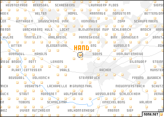
Hand (Nordrhein-Westfalen, Germany)Hand is a town in the Nordrhein-Westfalen region of Germany. An overview map of the region around Hand is displayed below.
regional and 3d topo map of Hand, Germany ::
nearby GPS traces from timatio ::
Hand airports ::
The nearest airport is GKE - Geilenkirchen, located 17.9 km north of Hand.
Other airports nearby include MST - Maastricht (23.3 km north west), LGG - Liege (46.5 km south west), MGL - Moenchengladbach Monchengladbach (57.5 km north east), DUS - Duesseldorf Dusseldorf (74.1 km north east), Nearby towns ::
Wildbach (0.0km north) //
Laurensberg (0.0km north) //
Grünenthal (1.2km west) //
Richterich (1.9km north) //
Ursfeld (2.2km north east) //
Försterheide (2.2km north west) //
Vetschau (2.2km north west) //
Wilsberg (2.2km north east) //
Soers (2.3km east) //
Berensberg (2.3km east) //
Bank (3.7km north) //
Seffent (3.0km south west) //
Rumpen (3.0km north east) //
Kämpchen (3.0km north east) //
Pannesheide (3.9km north) //
Vaals (4.4km south west) //
Vaalserquartier (4.4km south west) //
Burtscheid (4.4km south east) //
Klink-Heide (4.4km north east) //
Horbach (4.4km north west) //
Steinebrück (5.7km south) //
Lemiers (4.0km south west) //
Holset (4.0km south west) //
De Zandberg (4.0km north west) //
Vlengendaal (4.0km north west) //
Bocholtzerheide (4.0km north west) //
Bocholtz (4.0km north west) //
Gracht (5.7km north) //
Bleijerheide (5.7km north) //
[all distances 'as the bird flies' and approximate]  Places with similar names to Hand, Germany ::
Disclaimer :: Information on this page comes without warranty of any kind |
||
|
Where is Hand? Elevation and coordinates ::
Latitude (lat): 50°48'0"N Longitude (lon): 6°3'0"E
Elevation (approx.): 212m (map arrows pan, magnifying glasses zoom) |
||
|
Visiting Hand? Hotel/Accommodation ::
Book a hotel in Hand Travel Guide ::
Buy a travel guide for Germany rental cars ::
car rental offers GPS waypoint ::
download a GPX waypoint (PoI) of Hand for your GPS receiver
|
||