|
search place name
|
||
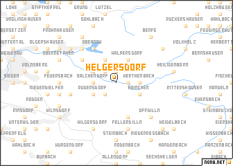
Helgersdorf (Nordrhein-Westfalen, Germany)Helgersdorf is a town in the Nordrhein-Westfalen region of Germany. An overview map of the region around Helgersdorf is displayed below.
regional and 3d topo map of Helgersdorf, Germany ::
Helgersdorf airports ::
The nearest airport is ZCA - Arnsberg Menden, located 71.4 km north of Helgersdorf.
Other airports nearby include CGN - Cologne Koln Bonn (73.3 km west), ZNV - Koblenz Winningen (76.0 km south west), DTM - Dortmund (82.8 km north west), PAD - Paderborn Lippstadt (88.5 km north), Nearby towns ::
Nenkersdorf (1.9km north) //
Irmgarteichen (1.2km east) //
Grissenbach (2.2km north west) //
Gernsdorf (2.2km south west) //
Salchendorf (2.3km west) //
Werthenbach (2.3km east) //
Nauholz (3.9km north) //
Deuz (3.0km north west) //
Walpersdorf (3.9km north) //
Rudersdorf (3.0km south west) //
Hainchen (3.0km south east) //
Dillbrecht (5.7km south) //
Beienbach (5.1km north west) //
Obernau (6.0km north west) //
Anzhausen (5.0km west) //
Fellerdilln (7.5km south) //
Brauersdorf (6.6km north west) //
Offdilln (6.6km south east) //
Wilgersdorf (7.8km south) //
Afholderbach (8.2km north west) //
Eschenbach (7.3km north west) //
Benfe (8.2km north east) //
Großenbach (7.3km north east) //
Oberroßbach (8.8km south east) //
[all distances 'as the bird flies' and approximate]  Places with similar names to Helgersdorf, Germany ::
// Heilgersdorf (DE)
// Hilgersdorf (DE)
Disclaimer :: Information on this page comes without warranty of any kind |
||
|
Where is Helgersdorf? Elevation and coordinates ::
Latitude (lat): 50°52'0"N Longitude (lon): 8°11'0"E
Elevation (approx.): 363m (map arrows pan, magnifying glasses zoom) |
||
|
Visiting Helgersdorf? Hotel/Accommodation ::
Book a hotel in Helgersdorf Travel Guide ::
Buy a travel guide for Germany rental cars ::
car rental offers GPS waypoint ::
download a GPX waypoint (PoI) of Helgersdorf for your GPS receiver
|
||