|
search place name
|
||
Helmeroth (Rheinland-Pfalz, Germany)Helmeroth is a town in the Rheinland-Pfalz region of Germany. An overview map of the region around Helmeroth is displayed below.
regional and 3d topo map of Helmeroth, Germany ::

Helmeroth airports ::
The nearest airport is CGN - Cologne Koln Bonn, located 44.2 km west of Helmeroth.
Other airports nearby include ZNV - Koblenz Winningen (47.6 km south), ZCA - Arnsberg Menden (84.2 km north), DTM - Dortmund (87.7 km north), DUS - Duesseldorf Dusseldorf (91.8 km north west), Nearby towns ::
Flögert (0.0km north) //
Kohlhardt (1.2km west) //
Stein-Wingert (1.9km south) //
Burbach (1.2km east) //
Kölbach (1.2km east) //
Langenbach (1.9km north) //
Idelberg (2.2km south west) //
Alhausen (2.2km south west) //
Ehrlich (2.2km south east) //
Bruchertseifen (2.2km north west) //
Thal (2.2km north west) //
Selbach (2.2km north east) //
Kroppach (3.7km south) //
Isert (2.3km west) //
Haderschen (2.3km west) //
Racksen (2.3km west) //
Niederingelbach (2.3km west) //
Fensdorf (2.3km east) //
Brunken (2.3km east) //
Köttingen (3.7km north) //
Giesenhausen (3.9km south) //
Eichelhardt (3.0km south west) //
Heuzert (3.9km south) //
Ehrlich (3.9km south) //
Roth (3.0km north west) //
Wintershof (3.0km south east) //
Obermörsbach (3.0km south east) //
Mörsbach (3.0km south east) //
Oettershagen (3.9km north) //
[all distances 'as the bird flies' and approximate] 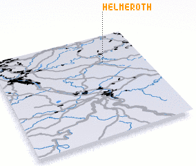 Places with similar names to Helmeroth, Germany :: Disclaimer :: Information on this page comes without warranty of any kind |
||
|
Where is Helmeroth? Elevation and coordinates ::
Latitude (lat): 50°44'0"N Longitude (lon): 7°44'0"E
Elevation (approx.): 195m (map arrows pan, magnifying glasses zoom) |
||
|
Visiting Helmeroth? Hotel/Accommodation ::
Book a hotel in Helmeroth Travel Guide ::
Buy a travel guide for Germany rental cars ::
car rental offers GPS waypoint ::
download a GPX waypoint (PoI) of Helmeroth for your GPS receiver
|
||