|
search place name
|
||
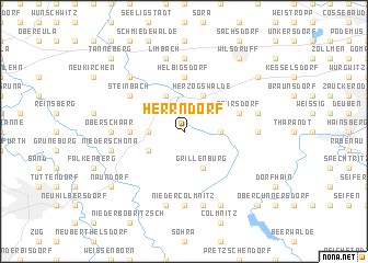
Herrndorf (Sachsen, Germany)Herrndorf is a town in the Sachsen region of Germany. An overview map of the region around Herrndorf is displayed below.
regional and 3d topo map of Herrndorf, Germany ::
Herrndorf airports ::
The nearest airport is DRS - Dresden, located 25.9 km north east of Herrndorf.
Other airports nearby include AOC - Altenburg Nobitz (68.6 km west), BBJ - Bautzen (76.3 km east), KLV - Karlovy Vary (95.7 km south west), LEJ - Leipzig Halle (100.1 km north west), Nearby towns ::
Grund (2.2km north west) //
Landberg (2.2km north east) //
Hutha (2.3km west) //
Wüsthetzdorf (2.3km west) //
Spechtshausen (2.3km east) //
Hetzdorf (3.0km south west) //
Grillenburg (3.9km south) //
Mohorn (3.9km north) //
Herzogswalde (3.9km north) //
Haida (3.5km west) //
Helbigsdorf (5.6km north) //
Pohrsdorf (4.0km north east) //
Steinbach (5.1km north west) //
Niedercolmnitz (7.4km south) //
Oberschaar (4.7km west) //
Birkenhain (7.4km north) //
Hintergersdorf (4.7km east) //
Kurort Hartha (4.7km east) //
Folge (7.5km south) //
Niederschöna (5.0km west) //
Am Bahnhof (7.5km south) //
Limbach (7.5km north) //
Fördergersdorf (5.0km east) //
Blankenstein (6.6km north west) //
Neuklingenberg (7.8km south) //
Naundorf (7.3km south west) //
Wilsdruff (8.2km north east) //
Grumbach (7.3km north east) //
Tanneberg (8.8km north west) //
[all distances 'as the bird flies' and approximate]  Places with similar names to Herrndorf, Germany ::
Disclaimer :: Information on this page comes without warranty of any kind |
||
|
Where is Herrndorf? Elevation and coordinates ::
Latitude (lat): 50°59'0"N Longitude (lon): 13°29'0"E
Elevation (approx.): 316m (map arrows pan, magnifying glasses zoom) |
||
|
Visiting Herrndorf? Hotel/Accommodation ::
Book a hotel in Herrndorf Travel Guide ::
Buy a travel guide for Germany rental cars ::
car rental offers GPS waypoint ::
download a GPX waypoint (PoI) of Herrndorf for your GPS receiver
|
||