|
search place name
|
||
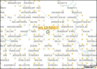
Hilgenreit (Bayern, Germany)Hilgenreit is a town in the Bayern region of Germany. An overview map of the region around Hilgenreit is displayed below.
regional and 3d topo map of Hilgenreit, Germany ::
Hilgenreit airports ::
The nearest airport is LNZ - Linz (Horsching), located 96.6 km south east of Hilgenreit.
Other airports nearby include SZG - Salzburg (119.1 km south), MUC - Munich Munchen (122.3 km south west), KLV - Karlovy Vary (152.6 km north), PRG - Prague Ruzyne (156.6 km north east), Nearby towns ::
Innernzell (0.0km north) //
Tumiching (1.2km east) //
Manglham (1.2km west) //
Mutzenwinkel (1.2km west) //
Schlag (1.9km south) //
Lungdorf (1.9km north) //
Gmünd (1.9km north) //
Unteröd (2.2km south east) //
Asberg (2.2km north east) //
Kleinarmschlag (2.2km north east) //
Oberöd (2.2km south east) //
Haunstein (2.2km south west) //
Kniereit (2.2km south west) //
Ort (2.2km north west) //
Bärnreuth (2.4km east) //
Bärndorf (3.7km south) //
Freundorf (2.4km west) //
Grünbach (3.9km north) //
Abtschlag (3.9km north) //
Vocking (3.1km south east) //
Großmisselberg (3.1km north east) //
Gerlesreuth (3.1km south east) //
Kaltenbrunn (3.1km north west) //
Schönbrunn (3.1km north west) //
Schöfweg (3.1km south west) //
Eppenschlag (4.4km north east) //
Hohenthan (4.4km north east) //
Fürstberg (4.4km north east) //
Solla (4.4km south east) //
[all distances 'as the bird flies' and approximate] 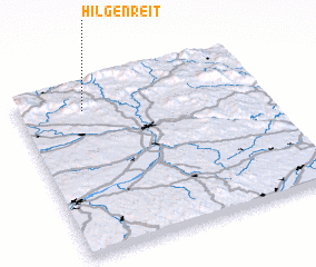 Places with similar names to Hilgenreit, Germany ::
Disclaimer :: Information on this page comes without warranty of any kind |
||
|
Where is Hilgenreit? Elevation and coordinates ::
Latitude (lat): 48°51'0"N Longitude (lon): 13°16'0"E
Elevation (approx.): 610m (map arrows pan, magnifying glasses zoom) |
||
|
Visiting Hilgenreit? Hotel/Accommodation ::
Book a hotel in Hilgenreit Travel Guide ::
Buy a travel guide for Germany rental cars ::
car rental offers GPS waypoint ::
download a GPX waypoint (PoI) of Hilgenreit for your GPS receiver
|
||