|
search place name
|
||
Hingen (Nordrhein-Westfalen, Germany)Hingen is a town in the Nordrhein-Westfalen region of Germany. An overview map of the region around Hingen is displayed below.
regional and 3d topo map of Hingen, Germany ::

Hingen airports ::
The nearest airport is GKE - Geilenkirchen, located 15.5 km south of Hingen.
Other airports nearby include MST - Maastricht (28.7 km south west), MGL - Moenchengladbach Monchengladbach (34.9 km north east), DUS - Duesseldorf Dusseldorf (54.4 km north east), EIN - Eindhoven (61.1 km north west), Nearby towns ::
Kollstraße (0.0km north) //
Bach (0.0km north) //
Hickeswinkel (0.0km north) //
Karken (1.2km east) //
Voorst (1.2km west) //
Annendaal (1.2km west) //
Voorsterveld (1.2km west) //
Karkerstraße (1.2km east) //
Laak (1.2km east) //
De Winkel (1.9km north) //
Vinn (1.9km south) //
Lümbach (1.9km south) //
Berg (2.2km south east) //
Werlo (2.2km south east) //
Haaserdriesch (2.2km south west) //
Haas (2.2km south west) //
Driesch (2.2km south west) //
Holst (3.7km north) //
Steinkirchen (2.3km east) //
End (2.3km east) //
Schuttorf (3.7km south) //
Posterholt (3.9km north) //
Theberath (3.0km south east) //
Mühlenbruch (3.0km south east) //
Neuhaaren (3.0km south west) //
Haaren (3.0km south west) //
Soperich (3.0km south west) //
Kirchhoven (3.9km south) //
Lieck (3.9km south) //
[all distances 'as the bird flies' and approximate] 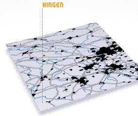 Places with similar names to Hingen, Germany ::
Disclaimer :: Information on this page comes without warranty of any kind |
||
|
Where is Hingen? Elevation and coordinates ::
Latitude (lat): 51°6'0"N Longitude (lon): 6°3'0"E
Elevation (approx.): 32m (map arrows pan, magnifying glasses zoom) |
||
|
Visiting Hingen? Hotel/Accommodation ::
Book a hotel in Hingen Travel Guide ::
Buy a travel guide for Germany rental cars ::
car rental offers GPS waypoint ::
download a GPX waypoint (PoI) of Hingen for your GPS receiver
|
||