|
search place name
|
||
Hinterwald (Rheinland-Pfalz, Germany)Hinterwald is a town in the Rheinland-Pfalz region of Germany. An overview map of the region around Hinterwald is displayed below.
regional and 3d topo map of Hinterwald, Germany ::

Hinterwald airports ::
The nearest airport is ZNV - Koblenz Winningen, located 14.2 km west of Hinterwald.
Other airports nearby include HHN - Frankfurt Hahn (49.3 km south west), FRA - Frankfurt Main (65.6 km south east), CGN - Cologne Koln Bonn (76.5 km north west), SPM - Spangdahlem Ab (81.0 km south west), Nearby towns ::
Becheln (1.9km north) //
Schweighausen (2.4km east) //
Dachsenhausen (3.9km south) //
Sulzbach (3.0km north east) //
Oberbachheim (4.4km south east) //
Frücht (4.4km north west) //
Bad Ems (5.6km north) //
Braubach (3.6km west) //
Erlenborn (5.6km south) //
Kehlbach (4.0km south east) //
Winterwerb (5.7km south) //
Friedrichssegen (4.0km north west) //
Niederbachheim (5.1km south east) //
Gemmerich (6.0km south east) //
Nievern (6.0km north west) //
Fachbach (6.0km north west) //
Misselberg (5.1km north east) //
Oberwies (4.7km east) //
Eisenbach (7.4km north) //
Dornholzhausen (5.1km east) //
Dessighofen (5.1km east) //
Eschbach (7.5km south) //
Dienethal (5.1km east) //
Niederspay (5.1km west) //
Miellen (6.6km north west) //
Dausenau (6.6km north east) //
Kemmenau (7.8km north) //
Oberspay (6.0km south west) //
Spay (6.0km south west) //
[all distances 'as the bird flies' and approximate] 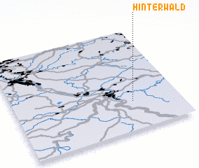 Places with similar names to Hinterwald, Germany ::
// Hinterwald (DE)
Disclaimer :: Information on this page comes without warranty of any kind |
||
|
Where is Hinterwald? Elevation and coordinates ::
Latitude (lat): 50°17'0"N Longitude (lon): 7°43'0"E
Elevation (approx.): 330m (map arrows pan, magnifying glasses zoom) |
||
|
Visiting Hinterwald? Hotel/Accommodation ::
Book a hotel in Hinterwald Travel Guide ::
Buy a travel guide for Germany rental cars ::
car rental offers GPS waypoint ::
download a GPX waypoint (PoI) of Hinterwald for your GPS receiver
|
||