|
search place name
|
||
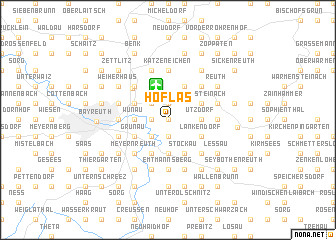
Höflas (Bayern, Germany)Höflas is a town in the Bayern region of Germany. An overview map of the region around Höflas is displayed below.
regional and 3d topo map of Höflas, Germany ::
Höflas airports ::
The nearest airport is BYU - Bayreuth, located 3.9 km north of Höflas.
Other airports nearby include HOQ - Hof Plauen (40.4 km north), NUE - Nuernberg Nurnberg (65.5 km south west), KLV - Karlovy Vary (94.8 km east), ERF - Erfurt (124.6 km north west), Nearby towns ::
Seulbitz (0.0km north) //
Döhlau (1.9km north) //
Oschenberg (1.9km north) //
Rodersberg (1.2km west) //
Juchhöh (1.9km south) //
Hilpertsgraben (1.9km south) //
Friedrichsthal (2.2km north west) //
Spinnerei (2.2km north west) //
Bauernhöfen (2.2km south west) //
Ützdorf (2.4km east) //
Görau (2.4km east) //
Wunau (2.4km west) //
Eremitenhof (2.4km west) //
Sankt Johannis (2.4km west) //
Geiersnest (2.4km west) //
Neunkirchen am Main (3.7km south) //
Allersdorf (3.9km north) //
Gemein (3.9km north) //
Pöllersdorf (3.9km north) //
Untersteinach (3.0km north east) //
Hammer (3.0km north east) //
Laineck (3.0km north west) //
Hartmannsreuth (3.0km south east) //
Lankendorf (3.0km south east) //
Aichig (3.0km south west) //
Grunau (3.0km south west) //
Stockau (3.9km south) //
Hühl (3.9km south) //
Bühl (3.9km south) //
[all distances 'as the bird flies' and approximate]  Places with similar names to Höflas, Germany ::
Disclaimer :: Information on this page comes without warranty of any kind |
||
|
Where is Höflas? Elevation and coordinates ::
Latitude (lat): 49°57'0"N Longitude (lon): 11°39'0"E
Elevation (approx.): 466m (map arrows pan, magnifying glasses zoom) |
||
|
Visiting Höflas? Hotel/Accommodation ::
Book a hotel in Höflas Travel Guide ::
Buy a travel guide for Germany rental cars ::
car rental offers GPS waypoint ::
download a GPX waypoint (PoI) of Höflas for your GPS receiver
|
||