|
search place name
|
||
Hotelkam (Bayern, Germany)Hotelkam is a town in the Bayern region of Germany. An overview map of the region around Hotelkam is displayed below.
regional and 3d topo map of Hotelkam, Germany ::

Hotelkam airports ::
The nearest airport is MUC - Munich Munchen, located 34.3 km west of Hotelkam.
Other airports nearby include FEL - Fuerstenfeldbruck Furstenfeldbruck (76.2 km west), OBF - Oberpfaffenhofen (81.5 km south west), SZG - Salzburg (95.1 km south east), AGB - Augsburg (95.2 km west), Nearby towns ::
Stützenbruck (0.0km north) //
Vils (0.0km north) //
Hohlhof (1.2km east) //
Hörlkam (1.2km east) //
Eging (1.2km west) //
Haunersdorf (2.2km north east) //
Haselbach (2.2km south east) //
Obergangkofen (2.2km north west) //
Untergangkofen (2.2km north west) //
Mantelkam (2.2km north west) //
Ankam (2.2km south west) //
Unterheldenberg (2.2km south west) //
Wörnstorf (2.2km south west) //
Oberheldenberg (2.2km south west) //
Feldkirchen (2.5km east) //
Rampoldsdorf (2.5km east) //
Geisenhausen (2.5km east) //
Neutzkam (3.7km south) //
Lehen (3.7km south) //
Peißing (2.5km west) //
Fimbach (3.9km north) //
Höhenberg (3.9km north) //
Götzdorf (3.9km north) //
Weihern (3.9km south) //
Reifersberg (3.1km south west) //
Riedlkam (3.1km south west) //
Perlkam (4.4km south east) //
Neutenkam (4.4km south east) //
Oberschneitberg (4.4km south east) //
[all distances 'as the bird flies' and approximate] 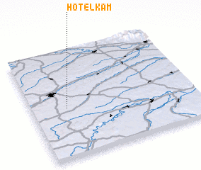 Places with similar names to Hotelkam, Germany :: Disclaimer :: Information on this page comes without warranty of any kind |
||
|
Where is Hotelkam? Elevation and coordinates ::
Latitude (lat): 48°28'0"N Longitude (lon): 12°13'0"E
Elevation (approx.): 457m (map arrows pan, magnifying glasses zoom) |
||
|
Visiting Hotelkam? Hotel/Accommodation ::
Book a hotel in Hotelkam Travel Guide ::
Buy a travel guide for Germany rental cars ::
car rental offers GPS waypoint ::
download a GPX waypoint (PoI) of Hotelkam for your GPS receiver
|
||