|
search place name
|
||
Hötzhof (Bayern, Germany)Hötzhof is a town in the Bayern region of Germany. An overview map of the region around Hötzhof is displayed below.
regional and 3d topo map of Hötzhof, Germany ::

Hötzhof airports ::
The nearest airport is LNZ - Linz (Horsching), located 92.3 km south east of Hötzhof.
Other airports nearby include SZG - Salzburg (120.3 km south), MUC - Munich Munchen (127.9 km south west), KLV - Karlovy Vary (153.7 km north), PRG - Prague Ruzyne (154.0 km north east), Nearby towns ::
Klebstein (0.0km north) //
Stadl (0.0km north) //
Pittrichsberg (0.0km north) //
Grafenhütt (1.2km east) //
Köpplhof (1.2km east) //
Mitternach (1.9km south) //
Unterhüttensölden (1.9km south) //
Hartmannsreit (1.9km north) //
Maukenreuth (2.2km south west) //
Raben (2.2km north west) //
Weberreuth (2.2km north west) //
Schönberg (2.2km south west) //
Rötz (2.2km north west) //
Kirchberg (2.2km south west) //
Frohnreuth (2.2km south west) //
Zehrerhof (2.4km west) //
Pummerhof (2.4km west) //
Seifertsreuth (2.4km west) //
Elsenthal (2.4km east) //
Bärnstein (2.4km east) //
Haibach (3.7km south) //
Eberhardsreuth (3.7km south) //
Augrub (3.9km north) //
Rammelsberg (3.1km south west) //
Almosenreuth (3.1km north west) //
Kleinmisselberg (3.1km north west) //
Lueg (3.1km south west) //
Voitschlag (3.1km north east) //
Grüb (3.1km north east) //
[all distances 'as the bird flies' and approximate] 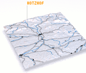 Places with similar names to Hötzhof, Germany ::
// Hetzhof (DE)
Disclaimer :: Information on this page comes without warranty of any kind |
||
|
Where is Hötzhof? Elevation and coordinates ::
Latitude (lat): 48°51'0"N Longitude (lon): 13°21'0"E
Elevation (approx.): 461m (map arrows pan, magnifying glasses zoom) |
||
|
Visiting Hötzhof? Hotel/Accommodation ::
Book a hotel in Hötzhof Travel Guide ::
Buy a travel guide for Germany rental cars ::
car rental offers GPS waypoint ::
download a GPX waypoint (PoI) of Hötzhof for your GPS receiver
|
||