|
search place name
|
||
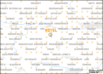
Hoyel (Niedersachsen, Germany)Hoyel is a town in the Niedersachsen region of Germany. An overview map of the region around Hoyel is displayed below.
regional and 3d topo map of Hoyel, Germany ::
Hoyel airports ::
The nearest airport is GUT - Guetersloh Gutersloh, located 29.3 km south of Hoyel.
Other airports nearby include FMO - Muenster/osnabrueck Munster Osnabruck (53.6 km west), PAD - Paderborn Lippstadt (62.3 km south), ZCA - Arnsberg Menden (85.5 km south west), HAJ - Hannover (89.3 km east), Nearby towns ::
Bennien (1.9km north) //
Westhoyel (1.1km west) //
Sandhorst (2.2km north west) //
Nordspenge (2.2km south east) //
Wallenbrück (2.2km south west) //
Helligen (2.2km south west) //
Gellenbrink (2.3km east) //
Hückerkreuz (2.3km east) //
Klein Aschen (2.9km north east) //
Groß Aschen (2.9km north east) //
Griesenbruch (2.9km south east) //
Westerengerheide (2.9km south east) //
Dreyen (2.9km south east) //
Bennierwald (3.9km north) //
Bruchmühlen (3.9km north) //
Siedlung Steinbrink (3.9km north) //
Heistersiek (3.9km south) //
Spenge (3.9km south) //
Spengerheide (3.9km south) //
Harrenheide (2.9km south west) //
Placken (2.9km south west) //
Diemke (3.9km south) //
Vorderbruch (4.3km north east) //
Barringdorf (4.3km south west) //
Mantershagen (4.3km south west) //
Kisker (5.6km south) //
Westkilver (5.6km north) //
Piepenbrink (3.9km north west) //
Riemsloh (3.9km north west) //
[all distances 'as the bird flies' and approximate]  Places with similar names to Hoyel, Germany ::
Disclaimer :: Information on this page comes without warranty of any kind |
||
|
Where is Hoyel? Elevation and coordinates ::
Latitude (lat): 52°10'0"N Longitude (lon): 8°28'0"E
Elevation (approx.): 114m (map arrows pan, magnifying glasses zoom) |
||
|
Visiting Hoyel? Hotel/Accommodation ::
Book a hotel in Hoyel Travel Guide ::
Buy a travel guide for Germany rental cars ::
car rental offers GPS waypoint ::
download a GPX waypoint (PoI) of Hoyel for your GPS receiver
|
||