|
search place name
|
||
Janahof (Bayern, Germany)Janahof is a town in the Bayern region of Germany. An overview map of the region around Janahof is displayed below.
regional and 3d topo map of Janahof, Germany ::

Janahof airports ::
The nearest airport is KLV - Karlovy Vary, located 113.0 km north of Janahof.
Other airports nearby include MUC - Munich Munchen (114.2 km south west), BYU - Bayreuth (114.6 km north west), NUE - Nuernberg Nurnberg (120.9 km west), HOQ - Hof Plauen (134.5 km north west), Nearby towns ::
Tasching (0.0km north) //
Gutmaning (1.2km east) //
Scharlau (1.2km west) //
Altenmarkt (1.2km west) //
Siechen (2.2km north east) //
Altenstadt (2.2km north east) //
Vilzing (2.2km south east) //
Höfen (2.2km south west) //
Cham (2.9km north) //
Katzberg (3.7km north) //
Nunsting (3.7km north) //
Hof (2.4km east) //
Trefling (3.7km south) //
Brunn (2.4km west) //
Zifling (3.9km north) //
Rissing (3.9km south) //
Hanzing (3.9km south) //
Katzbach (3.9km north) //
Chammünster (3.0km north east) //
Ried am Sand (3.1km south east) //
Wilting (3.9km south) //
Michelsdorf (3.0km north west) //
Radling (3.1km south west) //
Kammerdorf (4.4km north east) //
Schachendorf (4.4km south east) //
Oberhaid (4.4km south east) //
Schönferchen (4.4km south east) //
Loibling (4.4km north west) //
Thal (4.4km south west) //
[all distances 'as the bird flies' and approximate] 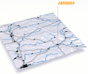
Disclaimer :: Information on this page comes without warranty of any kind |
||
|
Where is Janahof? Elevation and coordinates ::
Latitude (lat): 49°12'0"N Longitude (lon): 12°40'0"E
Elevation (approx.): 377m (map arrows pan, magnifying glasses zoom) |
||
|
Visiting Janahof? Hotel/Accommodation ::
Book a hotel in Janahof Travel Guide ::
Buy a travel guide for Germany rental cars ::
car rental offers GPS waypoint ::
download a GPX waypoint (PoI) of Janahof for your GPS receiver
|
||