|
search place name
|
||
Kirch Kogel (Mecklenburg-Vorpommern, Germany)Kirch Kogel is a town in the Mecklenburg-Vorpommern region of Germany. An overview map of the region around Kirch Kogel is displayed below.
regional and 3d topo map of Kirch Kogel, Germany ::

Kirch Kogel airports ::
The nearest airport is RLG - Laage, located 30.7 km north of Kirch Kogel.
Other airports nearby include SZW - Schwerin Parchim (35.5 km south west), LBC - Luebeck Lubeck Blankensee (97.1 km west), TXL - Berlin Tegel (142.7 km south east), THF - Berlin Tempelhof (155.0 km south east), Nearby towns ::
Rum Kogel (1.1km east) //
Louisenhof (1.9km north) //
Reimershagen (2.2km north east) //
Suckwitz (2.2km north west) //
Groß Breesen (3.7km north) //
Jellen (3.9km south) //
Schwinz (4.3km south west) //
Klein Breesen (4.3km north west) //
Alt Samitz (3.3km east) //
Bellin (5.7km north) //
Kleesten (3.8km south west) //
Marienhof (5.0km north east) //
Groß Tessin (4.8km north east) //
Klein Tessin (4.8km north east) //
Zehna (7.5km north) //
Oldenstorf (4.8km north west) //
Lohmen (5.7km north west) //
Gerdshagen (7.1km north west) //
Steinbeck (8.6km north east) //
[all distances 'as the bird flies' and approximate] 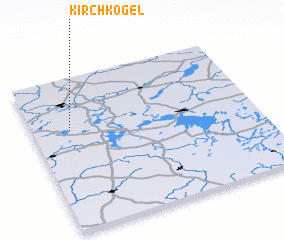 Places with similar names to Kirch Kogel, Germany :: Disclaimer :: Information on this page comes without warranty of any kind |
||
|
Where is Kirch Kogel? Elevation and coordinates ::
Latitude (lat): 53°39'0"N Longitude (lon): 12°10'0"E
Elevation (approx.): 62m (map arrows pan, magnifying glasses zoom) |
||
|
Visiting Kirch Kogel? Hotel/Accommodation ::
Book a hotel in Kirch Kogel Travel Guide ::
Buy a travel guide for Germany rental cars ::
car rental offers GPS waypoint ::
download a GPX waypoint (PoI) of Kirch Kogel for your GPS receiver
|
||