|
search place name
|
||
Lerchenberg (Sachsen, Germany)Lerchenberg is a town in the Sachsen region of Germany. An overview map of the region around Lerchenberg is displayed below.
regional and 3d topo map of Lerchenberg, Germany ::

Lerchenberg airports ::
The nearest airport is AOC - Altenburg Nobitz, located 37.7 km north of Lerchenberg.
Other airports nearby include KLV - Karlovy Vary (54.1 km south east), HOQ - Hof Plauen (67.4 km south west), LEJ - Leipzig Halle (90.9 km north), DRS - Dresden (97.1 km north east), Nearby towns ::
Grünau (0.0km north) //
Fährbrücke (0.0km north) //
Neudörfel (1.2km west) //
Wildenfels (1.9km north) //
An der Weinleite (1.9km north) //
Neumühle (2.2km north east) //
Langenbach (2.2km south east) //
Friedrichsthal (2.2km north west) //
Härtensdorf (3.7km north) //
NeueSorge (3.9km north) //
Weißbach (3.0km south west) //
Grießbach (5.6km south) //
Wiesenburg (3.5km west) //
Stein (3.5km east) //
Ortmannsdorf (5.6km north) //
Schneeberg (5.7km south) //
Staudenhäuser (4.0km south west) //
Schönau (4.0km north west) //
Wildbach (4.0km south east) //
Schlema (5.1km south east) //
Friedrichsgrün (5.1km north west) //
Zschocken (5.1km north east) //
Reinsdorf (6.0km north west) //
Wiesen (4.7km west) //
Neustädtel (7.4km south) //
Hartenstein (5.1km east) //
Neuschönburg (7.5km north) //
Mühlberg (7.5km south) //
Priesterhäuser (7.5km south) //
[all distances 'as the bird flies' and approximate] 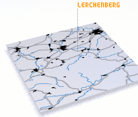 Places with similar names to Lerchenberg, Germany ::
Disclaimer :: Information on this page comes without warranty of any kind |
||
|
Where is Lerchenberg? Elevation and coordinates ::
Latitude (lat): 50°39'0"N Longitude (lon): 12°37'0"E
Elevation (approx.): 302m (map arrows pan, magnifying glasses zoom) |
||
|
Visiting Lerchenberg? Hotel/Accommodation ::
Book a hotel in Lerchenberg Travel Guide ::
Buy a travel guide for Germany rental cars ::
car rental offers GPS waypoint ::
download a GPX waypoint (PoI) of Lerchenberg for your GPS receiver
|
||