|
search place name
|
||
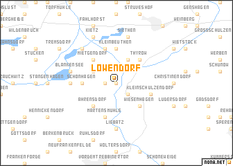
Löwendorf (Brandenburg, Germany)Löwendorf is a town in the Brandenburg region of Germany. An overview map of the region around Löwendorf is displayed below.
regional and 3d topo map of Löwendorf, Germany ::
Löwendorf airports ::
The nearest airport is SXF - Berlin Schonefeld, located 28.5 km north east of Löwendorf.
Other airports nearby include THF - Berlin Tempelhof (31.7 km north east), TXL - Berlin Tegel (38.6 km north), LEJ - Leipzig Halle (109.4 km south west), DRS - Dresden (126.8 km south), Nearby towns ::
Trebbin (0.0km north) //
Priedel (1.1km west) //
Kliestow (2.2km south east) //
Glau (2.9km north west) //
Kolonie Thyrow (3.9km north) //
Großbeuthen (3.9km north) //
Mietgendorf (4.3km north west) //
Thyrow (4.3km north east) //
Ahrensdorf (4.3km south west) //
Wiesenhagen (4.3km south east) //
Schönhagen (3.4km west) //
Kleinbeuthen (5.6km north) //
Märtensmühle (5.7km south) //
Klein Schulzendorf (3.9km south east) //
Jütchendorf (5.7km north) //
Liebätz (7.4km south) //
Schönblick (4.5km west) //
Siethen (7.5km north) //
Blankensee (4.9km west) //
Schiaß (6.5km north west) //
Kietz (7.8km north) //
Gröben (7.8km north) //
[all distances 'as the bird flies' and approximate] 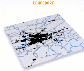
Disclaimer :: Information on this page comes without warranty of any kind |
||
|
Where is Löwendorf? Elevation and coordinates ::
Latitude (lat): 52°13'0"N Longitude (lon): 13°12'0"E
Elevation (approx.): 38m (map arrows pan, magnifying glasses zoom) |
||
|
Visiting Löwendorf? Hotel/Accommodation ::
Book a hotel in Löwendorf Travel Guide ::
Buy a travel guide for Germany rental cars ::
car rental offers GPS waypoint ::
download a GPX waypoint (PoI) of Löwendorf for your GPS receiver
|
||