|
search place name
|
||
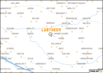
Lübtheen (Mecklenburg-Vorpommern, Germany)Lübtheen is a town in the Mecklenburg-Vorpommern region of Germany. An overview map of the region around Lübtheen is displayed below.
regional and 3d topo map of Lübtheen, Germany ::
Lübtheen airports ::
The nearest airport is SZW - Schwerin Parchim, located 48.7 km east of Lübtheen.
Other airports nearby include LBC - Luebeck Lubeck Blankensee (61.2 km north west), HAM - Hamburg (81.5 km north west), XFW - Hamburg Finkenwerder (86.9 km west), RLG - Laage (104.8 km north east), Nearby towns ::
Jessenitz (3.7km south) //
Quassel (3.7km north) //
Probst Jesar (2.2km east) //
Brömsenberg (3.9km north) //
Volzrade (3.9km south) //
Trebs (2.9km south east) //
Bandekow (4.3km north east) //
Gößlow (5.0km north east) //
Benz (6.0km south) //
Gudow (4.4km west) //
Briest (7.4km south) //
Garlitz (4.8km north west) //
Lübbendorf (4.8km north east) //
Melkof (6.5km north west) //
Neuenrode (6.5km north east) //
Goldenitz (7.7km north) //
Langenheide (7.1km north west) //
Vielank (8.1km south east) //
Neuenrode (7.1km north east) //
[all distances 'as the bird flies' and approximate]  Places with similar names to Lübtheen, Germany :: Disclaimer :: Information on this page comes without warranty of any kind |
||
|
Where is Lübtheen? Elevation and coordinates ::
Latitude (lat): 53°18'0"N Longitude (lon): 11°5'0"E
Elevation (approx.): 16m (map arrows pan, magnifying glasses zoom) |
||
|
Visiting Lübtheen? Hotel/Accommodation ::
Book a hotel in Lübtheen Travel Guide ::
Buy a travel guide for Germany rental cars ::
car rental offers GPS waypoint ::
download a GPX waypoint (PoI) of Lübtheen for your GPS receiver
|
||